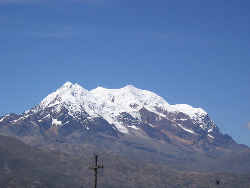
Ilimani: 4/15-18/2007
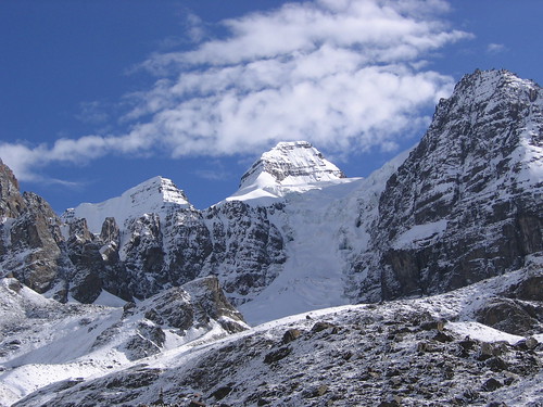
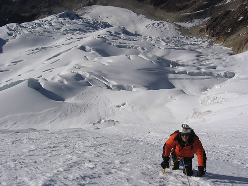
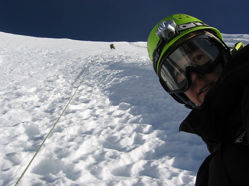
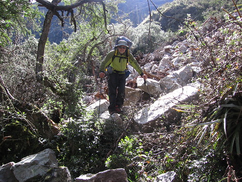
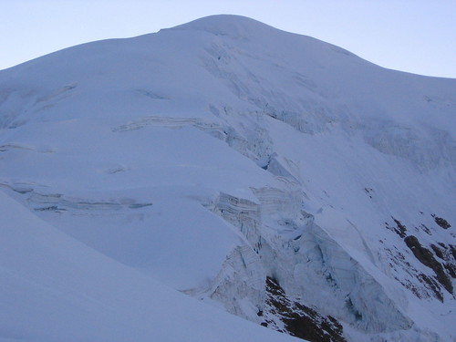
It is 4:00 am, an icy wind blows over the snow, we are above 20,000 feet, laboriously walking with each step breaking through a 3 inch crust. Under that crust is about 2 or 3 feet of sugar (ice crystals with no adhesion). Ahead is steepening up to crevasse wall, but looks like there is a way around it on the right. Breathing heavy, I take a step… I break through and fall back to where I started… I take another step, this one holds… another step.
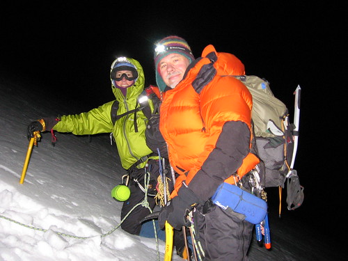
As we get higher, these snow conditions just get worse and worse. This crust is thick enough and strong enough that avalanche isn’t the main concern… the growing concern is protecting a fall on these steeper parts. The thick crust probably would not break through if you fell, you would just slide on top of it. Self arresting with ice axes is out of the question; the knife will just slice through this crust, and there is nothing to grab onto underneath. And the sugar isn’t going to hold pickets either… maybe if we dig down through it to whatever is under that… maybe. At this point our local guide stops and we all gather to confer about the conditions. We discuss the avalanche danger, and we discuss the potential scenarios given someone falling. Grrrrrrr….. a tough decision is made…. Grrrr… we turn around.
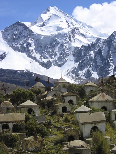
Ilimani (6462 m / 21,195 ft) holds a vital place in the lives and history of both the Aymara and Quechua people in Bolivia and Peru. Ilimani is an Apu. An Apu is a God, a person, and a mountain, all at the same time. Ilimani isn’t just any Apu either… it is the great Achachila and Wirajocho, the “King of the High Mountains of the Cordiellera Real” and also “Great God Owner of Water”.
Every year, in August, a ceremonial sacrifice of a white llama is made to Apu Ilimani. The blood represents richness, and is given in the hope that Ilimani will provide sufficient water for the year. After the ceremony are lively fiestas, in towns all around the mountain, with music and dances with white banners. Ilimani or Achachila or Wirajocho, what ever name it carries, is revered as the chief of the mountains/Apus, owner of all the forces of nature.
To walk on, or climb Ilimani, it is important to ask its permission, and to make offerings so that you can safely pass. In respect, we made offerings of corn, coca leaves, and pisco (grape liquor) at the base of the mountain. Our offerings were accepted by the Apu, in that we safely slept, climbed, and descended on the mountain, but it did not permit us to make it to the summit.
Two days ago, we drove on the long bumpy dirt road (for 4 hours) to a little pueblo on the west side of the mountain. When we arrived, our muleteers, a family living in the pueblo, got two horses and a burro ready to carry our gear to the base camp.
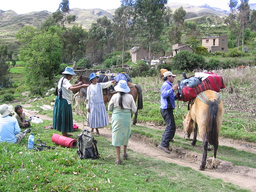
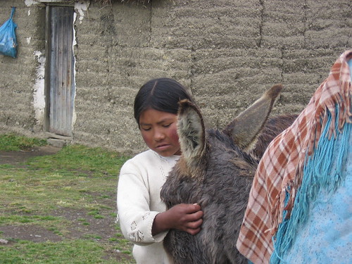
One of the horses was new to carrying gear, the one with my and Rod’s back packs on it, and flipped out on us. In wild panic, the horse started running up the road and around the field. Our packs slipped off its back and were being dragged on the ground until finally the horse fell onto the road and it’s reins grabbed a hold of. To the best of my knowledge, the horse was ok, but my back pack was not. The horse fell onto it and broke the metal frame (It also dented my titanium flask full of coca liqueur… bummer). After packing our gear onto the burro, we set off for the base camp, the animal handlers that came with us, our muleteers, were a 14 year old girl, in skirt and plastic sandals, and her 10 year old younger sister (also in skirt and plastic sandals). They were both very shy, and giggly.
We made base camp in a beautiful open green meadow. Black and white llamas were feeding as we set up our tents. We watched the girls and animals walk back home under a fabulous sunset. The next morning we dried our dew covered tents, sleeping bags, and gear in the sun as we waited for the porters to show up.
They are supposed to carry our heavy gear up to a high camp today. Soon we see three women in skirts and an old man (all in plastic sandals) walking across the meadow toward us. It certainly was humbling to watch these women pick up our heavy packs, strap them onto their backs, and with smiles and laughter, set off up the trail... especially when they were going up faster than we were.
Rod sinking to a New Low:
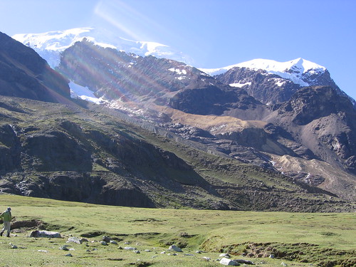
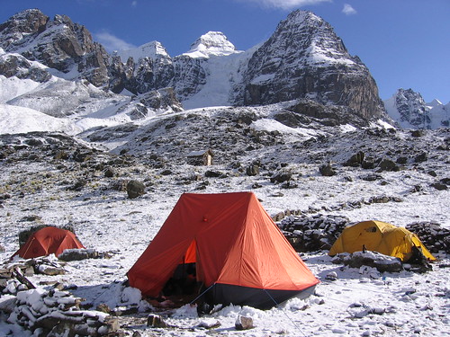
The high camp is on a flat, snow covered spot on the long narrow ridge up the south west face (elevation about 5500 m). Dinner that night gave us an amusing reminder of how low we’ve sunk, eating in Bolivia. Our dinner consisted of a big bowl of instant mashed potatoes with butter, and three boiled hotdogs. To spice it up a bit, we had some ketchup. I am not able to eat my whole portion, and have a half a hotdog sticking out my potatoes. Rod grabs my hotdog, pops it into his mouth in one shot, and exclaims delightedly (and honestly)…
”Yumm!!” That is how far it has gone.
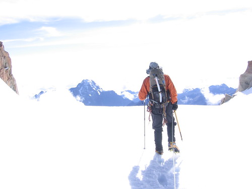
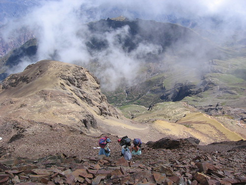
That night, at midnight, we woke up, ate a bit, and started our attempt to reach the summit. It was cold and windy, and clear skys made the southern cross and milkyway almost blinding. With not too much further to go (at about 6050 m), we turned around.

Back in camp, I was so cold from the decent, that I got into my -20 degree (Fahrenheit) down sleeping bag, and shivered for
an hour before falling asleep!! Later in the day, we rapelled down the snow fields to the south of the ridge as far as we could (10 pitches). Anything to minimize the knee destroying walk down the steep rocky trail.
When we made it back to the little pueblo that evening, we set up our tents by the house of the muleteer/porter family. They offered yesterday to kill a lamb for us and have a lamb and potatoes dinner waiting for our return. They set up a blanket on the ground for us to sit on, and laid another blanket, heaped with potatoes and pieces of lamb, on the ground in front of us. They cooked the lamb and potatoes in a rock lined hole in their field, with a fire above it. The potatoes and lamb were very plain, no spices, oil, or salt, yet were simply tasty. We sat on the ground eating with our fingers, sometimes swatting off chickens, dogs, donkeys, cows, or horses, who where interested in getting some scraps. The family was very friendly, and the children (there were many) spent the meal mostly staring at us. When I would smile or say something to one of the kids, they would shyly giggle and run away. One brave little boy started playing with Rod… they were growling at each other and making tiger claws. That same little boy stood outside our tent growling at us as we tried to go to sleep that night… he thought he was really funny.
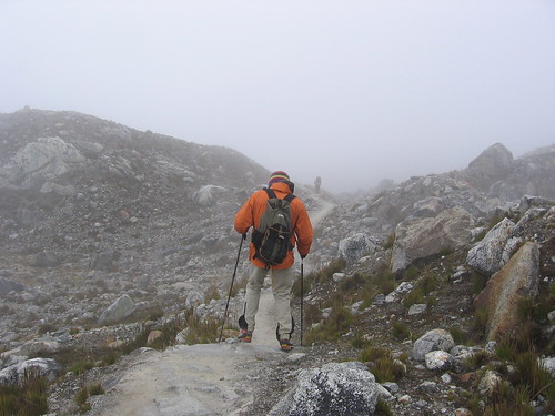
In the morning, the taxi came to take us back to La Paz. Waving goodbye to the family, we thought our adventure was at an end… little did we know. About 20 min into the bumpy drive, the driver stopped the car and popped the hood. What is going on?...the accelerator cable had broken. So all the men hunched over the engine, pulling wires, and jabbering excitedly.

Soon a nylon rope appeared, some wire, and a pair of pliers. They rigged the wire to the accelerator, and the rope through the passenger window. The guide sat in the passenger seat pulling on the rope to press the gas. The driver worked the clutch, steered, and directed the gas pulling… true team driving!
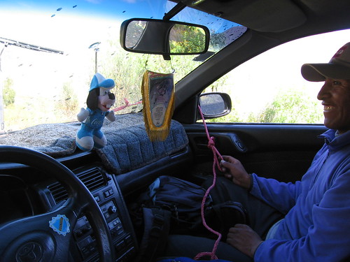
And this went on for 4 hours on steep, narrow, 1000 foot drop exposed, dirt roads! When we finally made it back to La Paz, everyone was a little frazzled and tired, but all generally pleased about the grand adventure with the great Apu Ilimani.

 Condoriri
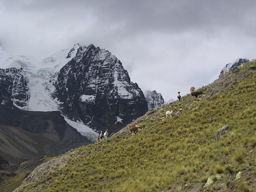
 Skipping stones