Iztaccihuatl
1/22/2007
Two massive volcanoes, Iztaccihuatl (5252 m, 17,332 ft) and Popocatepetl (5286 m, 17,444 ft) watch over central Mexico as a monument to the power of love. The story goes something like this... Izta was the daughter of the chief, and heir to the throne of a tribe/nation. Popo was the son of the chief, and heir to the throne of a rival neighboring tribe. At one point, the two chiefs thought that if their children fell in love, it would be a great opportunity to combine the power of these two tribes and solidify a larger area of rule. The two kids began meeting, and indeed fell in love. Unfortunately, as time passed, the two chiefs started to have disagreements and the idea of combining the tribes was dying. Afraid that he would not be allowed to be with Izta forever, Popo went to Izta's father directly and asked for her hand in marriage. The chief said that Popo could marry Izta if he went to battle for Izta's tribe. Popo, who was a strong warrior, went to the battle, promising Izta that he would soon return and be with her forever. But, the battle took longer than expected, and Popo did not return by the time he said. Izta was sure that he died in the battle, and herself died of grief. When Popo finally returned from the battle to find Izta dead, he took her body and carried it up a tall mountain, where he laid it down. Then, in grief, he climbed the mountain next to it and held a torch up to watch over his beloved, forever. The two became mountains. Iztaccihuatl means 'sleeping woman', and is shaped like the silhouette of a sleeping woman when viewed from the west. Popocatepetl is an active volcano, with a continuous plume of smoke from its crater, the smoke from his torch. And, it is said that Popo will continue to erupt, his torch will continue to burn, as long as young people continue to believe in the goddess of love.
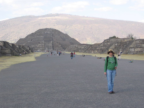
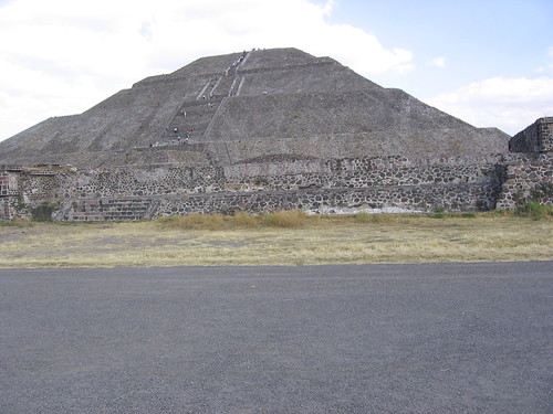
We had intended to climb both these lovers, but at the moment, Popo is erupting too much and climbing is banned. So we focused our attention on Izta. What a beautiful mountain! The colors, the textures!
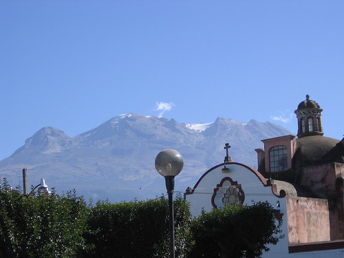
After a day´s preparation in the pueblito Amecameca (with a beautiful church, a great
 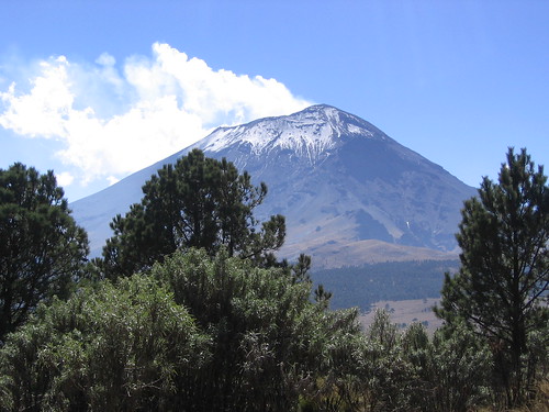 market, lots of stray dogs, and views of the mountains throughout town), we drove up the steep winding road to the little town/place of La Joya (13,000 ft). La Joya is the Izta trailhead, and basically a parking area, with two shacks serving food and drinks on the weekends.
  Instead of buying the
 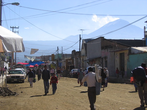 great local food, we opted to enjoy a scrumptious meal of dehydrated mashed potatoes with salami and tomato gravy while watching a truly beautiful sunset (enhanced by the thick smog layer above the valley below). After dinner, we went down to a bunkhouse/refuge for a short sleep. At 11:30 pm, the alarms went off, and we were up and stumbling around getting breakfast ready and climbing gear together. After burning the plastic regulator cover off our jetboil pot (stinky burning plastic wafting throughout the refuge), and stashing our sleeping stuff, we drove back to La Joya and hit the trail at 12:30 am. A respectable "alpine" start.
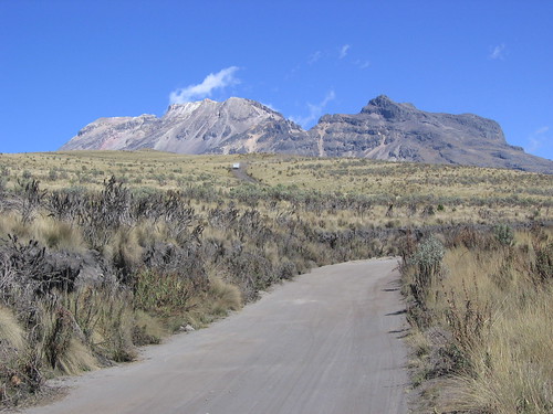

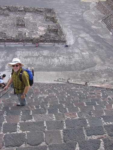
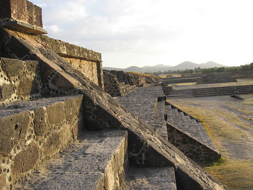
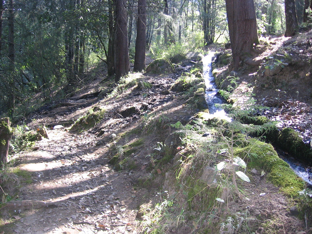
The trail started steeply, and our pace excruciatingly slow. The trail is not marked, and route finding was difficult both because it was dark, and because trails and alternative paths lead off everywhere. Once warmed up, we kept a solid pace and enjoyed the city lights views of Mexico City and Puebla. We got side tracked two times, had to backtrack, but found the trail again after a while. When the sun came up, the beautiful views, framed by the amazing verity of rock colors and prominent outcrops of Izta´s slopes, were just breathtaking. Such a pleasure to be with this great mountain.

The power of mine and Rod´s love as climbing partners was tested atop Izta´s Knees. The altitude, the fatigue, and nervousness about the down climb made Rod not want to continue. I on the other hand, was in a state of manic motivation to push for the summit. But that meant leaving Rod alone, with some altitude sickness indications, waiting in the cold wind on Izta´s Knees for a couple of hours. I chose to stay with Rod, and we began the descent. The talus glissade to the cliff band and down climbing the class 4 pitch was fun, but the rest of the walk down was grueling. The sandy/dusty trail is slippery and steep. Thank goodness for trekking poles!!
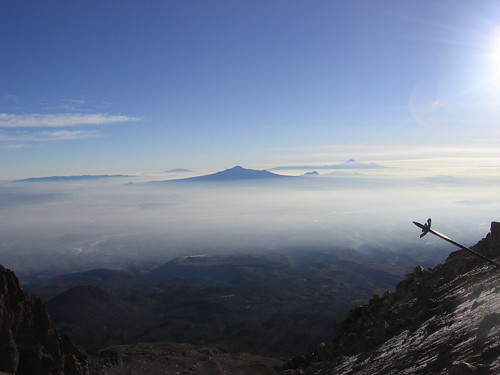
We eventually made it back to La Joya in good spirits. We were the only group of people on the mountain all day! Back in Amecameca, we got some food and headed strait to the hotel for the longest sleep of my life (to bed at 4:00 pm, awake at 7:30 am the next day)!
Izta will always hold a special place in my heart.
La Artista del Sol (ridge of the sun) route description:
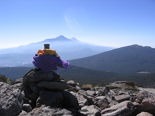
Climb from La Joya on the trail that goes directly up the steep hillside and then traverses left. This traverse is along the west side of the overall mountain ridge line. Get to the first col (primero portillo). This place has a large rock on the climbers right with a plaque on it. After the 1st col, the trail goes to the 2nd col (segundo portillo) on the east side of the ridge line. After the 2nd col, the trail travels back to the west side of the ridge and hugs the big rock face on climbers right. After the 3rd col, the trail again travels the east side. Here, you walk up along sandy traverse paths that come together at a narrow notch in the rocks. Go up through this notch, and the 4th col is in sight. The trails here get confusing, as they go in all directions (there is a big rock in the center of the col, and trails go to the left or right of it). Stay to climbers right of the big rock. Once on the col, walk up along the ridge (do not drop off the other side), and from the top of the hill, a refuge (Grupo de los Cien hut, 4750 m) is in sight. The hut has reflective painting on the side, so can be seen if climbing in the dark. From the refuge, walk strait up the large face in front of you with a cliff band across it. The passage through this cliff band is on the climbers right side. Finding the route through can be tricky (avoid going too far around the right edge of the face you are climbing), there is a large metal cross above the correct route. Follow easy 4th class rock to the metal cross. The trail from here is obvious to the top of the Feet. The metal skeleton remains of a hut are on top of The Feet (16,800 ft). The trail continues up and around minor peaks and moraines. Soon you reach the Stomach/Belly glacier, this was a simple snow field (1-2007), but there are stories of it having significant crevasses to be concerned about. Angle left to the ridge again, and continue on to the crater rim and the second glacier on the route. The broad summit plateau (the Breast) has three points that could be the summit. The route to the rim brings you to one of them, another is straight ahead on the east side, and the third is further and to the west. The true summit lies a little to the west of the false summit that is across the rim from where you gained the summit plateau approximately 30 m to the west of the false summit. There are easy to see crosses on the summit, at least when there is little to no snow.
1/22/2007
Two massive volcanoes, Iztaccihuatl (5252 m, 17,332 ft) and Popocatepetl (5286 m, 17,444 ft) watch over central Mexico as a monument to the power of love. The story goes something like this... Izta was the daughter of the chief, and heir to the throne of a tribe/nation. Popo was the son of the chief, and heir to the throne of a rival neighboring tribe. At one point, the two chiefs thought that if their children fell in love, it would be a great opportunity to combine the power of these two tribes and solidify a larger area of rule. The two kids began meeting, and indeed fell in love. Unfortunately, as time passed, the two chiefs started to have disagreements and the idea of combining the tribes was dying. Afraid that he would not be allowed to be with Izta forever, Popo went to Izta's father directly and asked for her hand in marriage. The chief said that Popo could marry Izta if he went to battle for Izta's tribe. Popo, who was a strong warrior, went to the battle, promising Izta that he would soon return and be with her forever. But, the battle took longer than expected, and Popo did not return by the time he said. Izta was sure that he died in the battle, and herself died of grief. When Popo finally returned from the battle to find Izta dead, he took her body and carried it up a tall mountain, where he laid it down. Then, in grief, he climbed the mountain next to it and held a torch up to watch over his beloved, forever. The two became mountains. Iztaccihuatl means 'sleeping woman', and is shaped like the silhouette of a sleeping woman when viewed from the west. Popocatepetl is an active volcano, with a continuous plume of smoke from its crater, the smoke from his torch. And, it is said that Popo will continue to erupt, his torch will continue to burn, as long as young people continue to believe in the goddess of love.
We had intended to climb both these lovers, but at the moment, Popo is erupting too much and climbing is banned. So we focused our attention on Izta. What a beautiful mountain! The colors, the textures!
After a day´s preparation in the pueblito Amecameca
(with a beautiful church, a great market, lots of stray dogs, and views of the mountains throughout town), we drove up the steep winding road to the little town/place of La Joya (13,000 ft). La Joya is the Izta trailhead, and basically a parking area, with two shacks serving food and drinks on the weekends. Instead of buying the great local food, we opted to enjoy a scrumptious meal of dehydrated mashed potatoes with salami and tomato gravy while watching a truly beautiful sunset (enhanced by the thick smog layer above the valley below). After dinner, we went down to a bunkhouse/refuge for a short sleep. At 11:30 pm, the alarms went off, and we were up and stumbling around getting breakfast ready and climbing gear together. After burning the plastic regulator cover off our jetboil pot (stinky burning plastic wafting throughout the refuge), and stashing our sleeping stuff, we drove back to La Joya and hit the trail at 12:30 am. A respectable "alpine" start.The trail started steeply, and our pace excruciatingly slow. The trail is not marked, and route finding was difficult both because it was dark, and because trails and alternative paths lead off everywhere. Once warmed up, we kept a solid pace and enjoyed the city lights views of Mexico City and Puebla. We got side tracked two times, had to backtrack, but found the trail again after a while. When the sun came up, the beautiful views, framed by the amazing verity of rock colors and prominent outcrops of Izta´s slopes, were just breathtaking. Such a pleasure to be with this great mountain.
The power of mine and Rod´s love as climbing partners was tested atop Izta´s Knees. The altitude, the fatigue, and nervousness about the down climb made Rod not want to continue. I on the other hand, was in a state of manic motivation to push for the summit. But that meant leaving Rod alone, with some altitude sickness indications, waiting in the cold wind on Izta´s Knees for a couple of hours.
I chose to stay with Rod, and we began the descent. The talus glissade to the cliff band and down climbing the class 4 pitch was fun, but the rest of the walk down was grueling. The sandy/dusty trail is slippery and steep. Thank goodness for trekking poles!! We eventually made it back to La Joya in good spirits. We were the only group of people on the mountain all day! Back in Amecameca, we got some food and headed strait to the hotel for the longest sleep of my life (to bed at 4:00 pm, awake at 7:30 am the next day)!
Izta will always hold a special place in my heart.
La Artista del Sol (ridge of the sun) route description:
Climb from La Joya on the trail that goes directly up the steep hillside and then traverses left. This traverse is along the west side of the overall mountain ridge line. Get to the first col (primero portillo). This place has a large rock on the climbers right with a plaque on it. After the 1st col, the trail goes to the 2nd col (segundo portillo) on the east side of the ridge line. After the 2nd col, the trail travels back to the west side of the ridge and hugs the big rock face on climbers right. After the 3rd col, the trail again travels the east side. Here, you walk up along sandy traverse paths that come together at a narrow notch in the rocks. Go up through this notch, and the 4th col is in sight. The trails here get confusing, as they go in all directions (there is a big rock in the center of the col, and trails go to the left or right of it). Stay to climbers right of the big rock. Once on the col, walk up along the ridge (do not drop off the other side), and from the top of the hill, a refuge (Grupo de los Cien hut, 4750 m) is in sight. The hut has reflective painting on the side, so can be seen if climbing in the dark. From the refuge, walk strait up the large face in front of you with a cliff band across it. The passage through this cliff band is on the climbers right side. Finding the route through can be tricky (avoid going too far around the right edge of the face you are climbing), there is a large metal cross above the correct route. Follow easy 4th class rock to the metal cross. The trail from here is obvious to the top of the Feet. The metal skeleton remains of a hut are on top of The Feet (16,800 ft). The trail continues up and around minor peaks and moraines. Soon you reach the Stomach/Belly glacier, this was a simple snow field (1-2007), but there are stories of it having significant crevasses to be concerned about. Angle left to the ridge again, and continue on to the crater rim and the second glacier on the route. The broad summit plateau (the Breast) has three points that could be the summit. The route to the rim brings you to one of them, another is straight ahead on the east side, and the third is further and to the west. The true summit lies a little to the west of the false summit that is across the rim from where you gained the summit plateau approximately 30 m to the west of the false summit. There are easy to see crosses on the summit, at least when there is little to no snow.

