Monday, February 26, 2007
Saturday, February 24, 2007
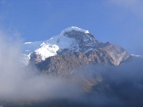
Mt Cayambe
Mt Cayambe: 2/23-25/2007
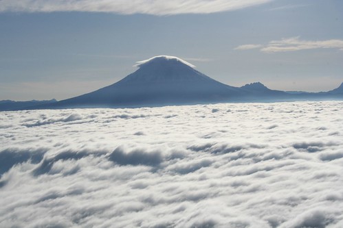
Located exactly on the equator, Cayambe is place of paradox and wonder. It is the highest spot on the equator in the world. It is so strange to see such superb glaciers at a place conventionally thought tropical. This is an icy, harsh, strong, and beautiful mountain... no tropical paradise!
... although, it is a tropical paradise ...
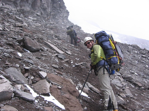
Of all the mountains in Ecuador we have visited, to me, Cayambe is the most beautiful and magnificent. On it's north side the area is a designated an Ecological Reserve. The one road through the area winds up through high tropical forest, then into grasslands scattered with odd funky jungle plants, then stops at a view of these equatorial glaciers. We drove up to the end of the road, to some antennae on a hill, then walked further up the valley to view the north face climbing route (this photo is a view of the north face).
We decided not to climb the north route, and go tomorrow to climb the more popular southern route. But, this north side is so special, the place is awe inspiring, and the route looks really exciting. This is one of the spots we are visiting on this trip that I most certainly want to come back to and spend more time. I don't think Cayambe should be an Ecological Reserve. I think the Ecuador government is making a big mistake not making this a National Park.
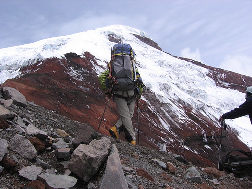
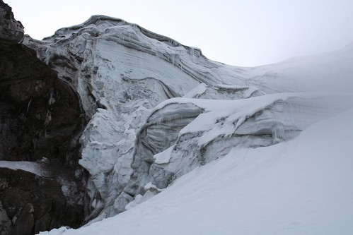
The next day we drove up the rough rocky road to the refuge at the base of the south face. The wind was blowing hard and cold as we unloaded our gear from the car and set up our beds in the refuge. After a warm snack, we walked up the rocky first section of the route to the head of the glacier. It was blowing so hard it knocked me over once, and the spits of rain covered the rocks with a slippery layer of clear ice.
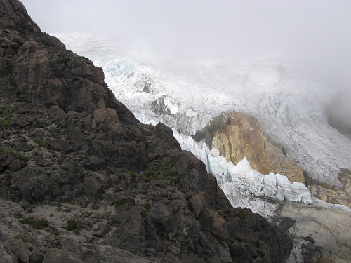
Back at the refuge, we ate some dinner, talked to another group of climbers there about the route and climbing strategies, then got into bed before sunset. At midnight the whole refuge was up and nosily getting ready to climb... sorting gear, eating breakfast, filling water bottles with hot water. We could hear the wind howling and gusting outside. When we went out, it was much worse than we thought. At the refuge (i.e low elevation) the wind was gusting to 60 mph, and sending missiles of frozen rain into our faces. What was happening up high?
After standing outside for about 15 minutes, discussing, evaluating, arguing, freezing, we decided not to climb. The weather was just too bad. Part of the other climbing group decided to go for it. We got back into our sleeping bags feeling a little embarrassed, a little inadequate, a little pathetic, and wondering if the bad weather would let up, and if the other group would be at the summit after a great climb while we sat eating breakfast down in the refuge.
At about 3:00 am, we were awoken by the loud boots and voices of the other group returning to the refuge. They said that the climb was horrendous. They made it to the head of the glacier, but the wind was so strong, it was blowing people over, and on slick exposed ice, that is not a situation to be in. And it was just getting worse. On the walk back to the refuge the icy rocky trail was so dangerous with the wind, they had to set up rappels. Needless to say, we guiltily felt great that we had made the right decision not to climb.
Located exactly on the equator, Cayambe is place of paradox and wonder. It is the highest spot on the equator in the world. It is so strange to see such superb glaciers at a place conventionally thought tropical. This is an icy, harsh, strong, and beautiful mountain... no tropical paradise!
... although, it is a tropical paradise ...
Of all the mountains in Ecuador we have visited, to me, Cayambe is the most beautiful and magnificent. On it's north side the area is a designated an Ecological Reserve. The one road through the area winds up through high tropical forest, then into grasslands scattered with odd funky jungle plants, then stops at a view of these equatorial glaciers. We drove up to the end of the road, to some antennae on a hill, then walked further up the valley to view the north face climbing route (this photo is a view of the north face).
We decided not to climb the north route, and go tomorrow to climb the more popular southern route. But, this north side is so special, the place is awe inspiring, and the route looks really exciting. This is one of the spots we are visiting on this trip that I most certainly want to come back to and spend more time. I don't think Cayambe should be an Ecological Reserve. I think the Ecuador government is making a big mistake not making this a National Park.
The next day we drove up the rough rocky road to the refuge at the base of the south face. The wind was blowing hard and cold as we unloaded our gear from the car and set up our beds in the refuge. After a warm snack, we walked up the rocky first section of the route to the head of the glacier. It was blowing so hard it knocked me over once, and the spits of rain covered the rocks with a slippery layer of clear ice.
Back at the refuge, we ate some dinner, talked to another group of climbers there about the route and climbing strategies, then got into bed before sunset. At midnight the whole refuge was up and nosily getting ready to climb... sorting gear, eating breakfast, filling water bottles with hot water. We could hear the wind howling and gusting outside. When we went out, it was much worse than we thought. At the refuge (i.e low elevation) the wind was gusting to 60 mph, and sending missiles of frozen rain into our faces. What was happening up high?
After standing outside for about 15 minutes, discussing, evaluating, arguing, freezing, we decided not to climb. The weather was just too bad. Part of the other climbing group decided to go for it. We got back into our sleeping bags feeling a little embarrassed, a little inadequate, a little pathetic, and wondering if the bad weather would let up, and if the other group would be at the summit after a great climb while we sat eating breakfast down in the refuge.
At about 3:00 am, we were awoken by the loud boots and voices of the other group returning to the refuge. They said that the climb was horrendous. They made it to the head of the glacier, but the wind was so strong, it was blowing people over, and on slick exposed ice, that is not a situation to be in. And it was just getting worse. On the walk back to the refuge the icy rocky trail was so dangerous with the wind, they had to set up rappels. Needless to say, we guiltily felt great that we had made the right decision not to climb.
Tuesday, February 20, 2007
Monday, February 19, 2007
Mt Chimborazo
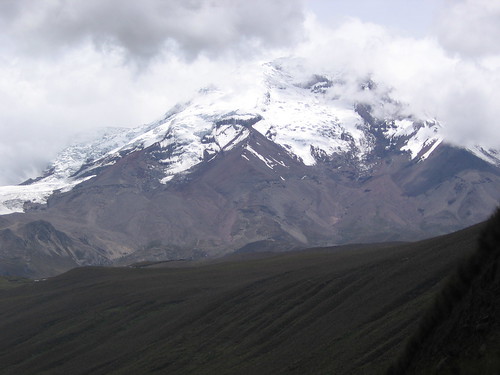
Chimborazo: 2/16,17,18/2007
Chimborazo was in love with Tungurahua, the slender, tall, fiery, and explosive volcano to the east. But some other mountains were courting her too. Mt. Altar and Mt. Carihuairazo each also wanted Tungurahua as his wife. They all thought she was Hot! Chimborazo is a very big guy. He decided to bash the heads in of his rivals. He beat up Altar, so now Altar’s summit is a massive blown out crater ringed by a number of jagged, rocky pinnacles. He beat up Carihuairazo. His summit is now just a thin pointy block of rock. After taking care of her other suitors, he and Tungurahua got married.
Chimborazo is indeed a MASSIVE mountain.
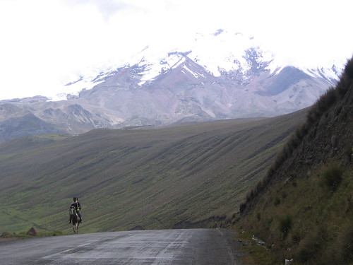 6270 m, or 20,670 feet tall, for many years it was thought to be the tallest mountain on Earth. It turns out that the summit of Chimborazo is the point on earth closest to the Sun. How can this be? What about the Himalayas? Chimborazo’s latitude is very close to the equator, and remember that Earth has an equatorial bulge. If you measure altitude from sea level, the mountain is 6270 m, but if you measure the altitude as distance from the center of Earth, it is the tallest mountain in the world; closest to the sun. And for the Quechua people, the descendents of the children of the Sun, this is a very sacred place.
We hired a local guide for our Chimborazo attempt. The logistics of getting to the mountain refuge and route finding were made a lot easier having someone who knows the terrain with us. We all squeezed into the truck in Los Banos and drove 3 hours up to the Carrel Refugio (4850 m) on the SW face. Because it is a dry year, and the glaciers are receding rapidly. The approach from the Whimper Refugio, climbing the Normal Route, had too much rock fall and bad ice. We decided on a route that followed a ridge to the east of the Normal Route, up to the Castillo (a prominent rock and landmark), then continued on the ridge to gain the glacier, then followed the normal route from there. And we decided to do it in two parts, using a high camp at the Castillo. We thought this would be better for successful acclimatization.
After arriving at the Carrel Refugio and deciding on our plan, we packed up our high camp gear and trekked up to the ridge that leads to the Castillo. It was starting to snow and get icy, so we left our stuff there under a tarp and headed back to the Refugio. There was no need to get up early in the morning, so we spent the evening having a leisurely dinner and playing cards. The next day was Rod’s birthday! In the morning we had a candle in his breakfast and sang happy birthday. Then we packed up our sleeping bags and few other things, and headed up to make high camp. We picked up our bags we left the day before, and continued up the ridge. Soon, we had to head climber’s right and traverse under the rock formations on the ridge. This was a hard, slippery, steep, loose, long, tedious, hell-walk!
 But we finally made it past the cliffs and back onto the ridge, right at the Castillo. We set up camp on top of the Castillo,
  and had a beautiful warm sunny afternoon looking over the clouds.
  A nice birthday for Rod. We ate dinner early, and went to sleep at 6:00… wake up time, 11:30pm.
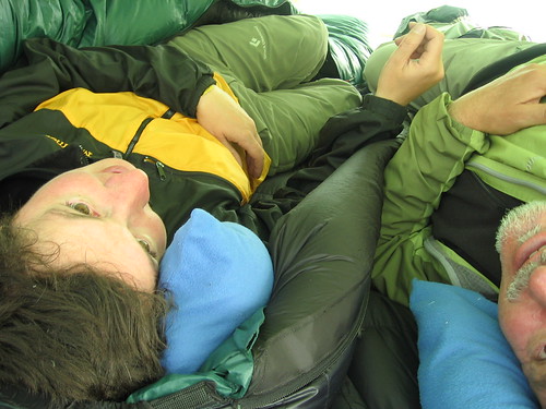
We got up on time, ate some breakfast, packed our climbing packs and started up. The crux of the climb is right at the beginning. To gain the glacier, we had to cross some very exposed rock covered ice, then climb a steep pitch of normal ice. The rock covered ice was really tricky because it looked just like loose gravel, but it was gravel frozen on top of, or cemented by, ice that was not visible. It was very hard, and difficult to protect. We climbed it on belay with ice axes and crampons. Then to the steep pitch of ice… we climbed this setting ice screws and a belay anchor at the top.
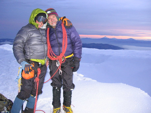
 Now that we are up onto the glacier, the rest is just one long, long, long, seemingly endless slog to the top. We walked, and walked. And all of a sudden, the ground started to level, and we were walking around on the Veintimilla summit! WhooHooo! Standing on the closest point to the sun, the summit of Chimborazo!
Chimborazo has several different summits that are approached from different routes. But at the top, it is all pretty much level, the summits are only one or tow hundred feet or so different in height. The highest summit is about 1 km east of the Veintimilla summit across the summit plateau (1/2 hr walk in good conditions). Because it has been a dry year in Ecuador, the summit plateau was riddled with crevasses and seracs instead of being all smooth and covered with snow. We searched for a way to cross the icy jumble to gain the main summit, but it was just a mess up there. So we hung out on the Veintimilla summit and watched the sun rise over a cloud sea with the peaks of the other big volcanoes poking through… Cotopaxi, Sangay, Carihuairazo, Altar, Illinizas, Antisana… beautifully!
We thanked the mountain for practicing with us, and his lessons, and headed down. The long, long, long, seemingly endless way down. Maybe one of the lessons of Chimborazo was “It never ends. Everything just goes on and on.” On the drive back to Los Banos we stopped in a filthy little restaurant/stand for ‘fritata’. A super yummy side of the road meal, where they hang a whole gutted and skinned pig on a hook, and when you order they cut off some meat and fry it in who knows what, and serve it with hominy (big white corn kernels). Yum. Then to top the trip off, when we got back to Los Banos, we were pleasantly surprised to find out that the town was in the middle of its annual Carnival! Fiesta!
Sunday, February 18, 2007
Mt Tunguruhua
Banos/Tungurahua; 2/13,14,15&19,20/2007
After coming down from Illiniza Sur, we headed south to the tourist town of Los Banos. Yes, really the name of the town is Los Banos. It’s called that because it has several natural mineral springs, both cold and hot, in town and in the general area. Los Banos sits halfway up the side of the massive and very active, Volcan Tungurahua. In 1999, Tungurahua blew its top big time. It sent a huge mud/ash slide down to the side of Los Banos that burned and covered (still covers) everything in its way (houses, forest, the road, etc). It sent molten pumice and ash into the sky that was carried to other near by peaks covering their glaciers with dust and gravel. The town of Los Banos was evacuated for months, but now, despite the occasional mild eruption, bustles with activity and tourism. Our original intention was to climb Tungurahua, but because of the eruptions, we would need gas masks and fire-retarding clothing, so that idea is out. Instead, we spent a few days relaxing, hot-springing, and prepping for an attempt at mount Chimborazo.
Chimborazo and Tungurahua are integrally linked in the legends. Chimborazo was in love with Tungurahua (she’s hot!), but some other mountains were courting her too. Mt. Altar and Mt. Carihuairazo each also wanted Tungurahua as his wife. It seems Chimborazo was a big brute because he went and beat up his rivals, he really thrashed them. Then he and Tungurahua got married. Tungurahua is known to the Quichua people as Mama Tungurahua, or Mother Tungurahua, and is a very sacred site.
From the 16th to the 18th we left Los Banos to climb Chimborazo (see the Chimborazo blog entry), then returned to Los Banos just in time for the last two days of the Los Banos Carnival! This is the whole regions big blow out party before lent starts. The town was flooded with folks from all the surrounding area, even Quito, and every hotel room in the town was booked. The streets had live music, outdoor cafes and booths selling all sorts of tasty specialties and treats, booths selling goods ranging from alpaca sweaters to oil paintings to the newest non-stick cookware. It was crowded, loud, at times out of control, and fun! The most common ruckus was the way too popular activity of spraying each other with cans of shaving cream. At times a cloud of shaving cream mist made it hard to see more than 10 feet, or shaving cream landed in your beer while sitting at an outdoor café, or you just got half your body covered with pink foam as you walked along.
The best part of the Carnival was on the last night. There was a fun band with a big brass section playing in the big square in front of the church. Lots of people were dancing and hanging out. Then, some fireworks started going off from the roof of the church. These also included some really cool colorful hot air balloons in the shape of stars or spheres that they would send up by setting a small fire in the basket at the bottom. We would watch them slowly float up into the stars and disappear. This all was great, until the real fireworks started. There was a small platform in the middle of the square (a square that was crowded with people) that was about 5 feet above the rest of the square. They set up a fireworks launch right there! These were not the kind of fireworks you set off on the 4th of July; they are the kind Disneyland sets off on the 4th of July… the big stuff. They would light up the firework, then run frantically to the other end of the little platform, sometimes reaching a safe distance before the explosion on the ground sent the firework into the air. We were right there, everyone was! The explosion launching the little rockets was almost as big, and certainly as loud, as the firework itself. To watch these guys try to run away from the explosions, have the explosion happen right in front of you, have some of the rockets misfire and send flaming balls onto the rooftops, and get a great fireworks show on top of that made it just about the best fireworks show I’ve ever seen!
I guess when you live on the side of an erupting volcano, some big ‘ol fireworks aren’t a big deal.
After coming down from Illiniza Sur, we headed south to the tourist town of Los Banos. Yes, really the name of the town is Los Banos.
It’s called that because it has several natural mineral springs, both cold and hot, in town and in the general area. Los Banos sits halfway up the side of the massive and very active, Volcan Tungurahua. In 1999, Tungurahua blew its top big time. It sent a huge mud/ash slide down to the side of Los Banos that burned and covered (still covers) everything in its way (houses, forest, the road, etc). It sent molten pumice and ash into the sky that was carried to other near by peaks covering their glaciers with dust and gravel. The town of Los Banos was evacuated for months, but now, despite the occasional mild eruption, bustles with activity and tourism. Our original intention was to climb Tungurahua, but because of the eruptions, we would need gas masks and fire-retarding clothing, so that idea is out. Instead, we spent a few days relaxing, hot-springing, and prepping for an attempt at mount Chimborazo.Chimborazo and Tungurahua are integrally linked in the legends. Chimborazo was in love with Tungurahua (she’s hot!), but some other mountains were courting her too. Mt. Altar and Mt. Carihuairazo each also wanted Tungurahua as his wife.
It seems Chimborazo was a big brute because he went and beat up his rivals, he really thrashed them. Then he and Tungurahua got married. Tungurahua is known to the Quichua people as Mama Tungurahua, or Mother Tungurahua, and is a very sacred site.From the 16th to the 18th we left Los Banos to climb Chimborazo (see the Chimborazo blog entry), then returned to Los Banos just in time for the last two days of the Los Banos Carnival! This is the whole regions big blow out party before lent starts. The town was flooded with folks from all the surrounding area, even Quito, and every hotel room in the town was booked. The streets had live music, outdoor cafes and booths selling all sorts of tasty specialties and treats, booths selling goods ranging from alpaca sweaters to oil paintings to the newest non-stick cookware. It was crowded, loud, at times out of control, and fun! The most common ruckus was the way too popular activity of spraying each other with cans of shaving cream. At times a cloud of shaving cream mist made it hard to see more than 10 feet, or shaving cream landed in your beer while sitting at an outdoor café, or you just got half your body covered with pink foam as you walked along.
The best part of the Carnival was on the last night. There was a fun band with a big brass section playing in the big square in front of the church. Lots of people were dancing and hanging out. Then, some fireworks started going off from the roof of the church. These also included some really cool colorful hot air balloons in the shape of stars or spheres that they would send up by setting a small fire in the basket at the bottom. We would watch them slowly float up into the stars and disappear. This all was great, until the real fireworks started. There was a small platform in the middle of the square (a square that was crowded with people) that was about 5 feet above the rest of the square. They set up a fireworks launch right there! These were not the kind of fireworks you set off on the 4th of July; they are the kind Disneyland sets off on the 4th of July… the big stuff. They would light up the firework, then run frantically to the other end of the little platform, sometimes reaching a safe distance before the explosion on the ground sent the firework into the air. We were right there, everyone was! The explosion launching the little rockets was almost as big, and certainly as loud, as the firework itself. To watch these guys try to run away from the explosions, have the explosion happen right in front of you, have some of the rockets misfire and send flaming balls onto the rooftops, and get a great fireworks show on top of that made it just about the best fireworks show I’ve ever seen!
I guess when you live on the side of an erupting volcano, some big ‘ol fireworks aren’t a big deal.
Saturday, February 17, 2007
Mt Iliniza Sur
Illiniza Sur: 2/11,12,13/2007
Illiniza Norte and Illiniza Sur make up the peaks known as the Illinizas. A long long time ago, the son of a local leader, and the daughter of a rival leader fell in love. The boys’ father was not happy about this, and he hired a wizard to take care of the situation. The wizard took the girl and using powerful magic, he turned her to stone. He turned her into Illiniza Norte. Now the boy was devastated. He did not know what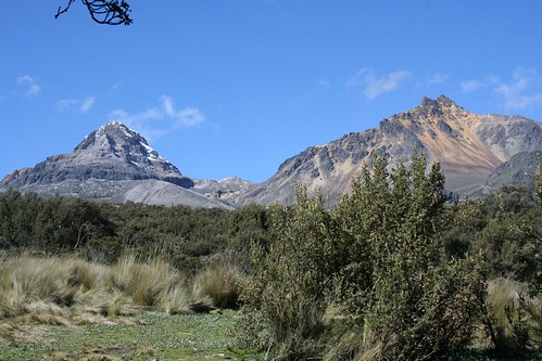 happened to his love. He abandoned his father and set out looking for her. For years he traveled up and down the paramo, searching and telling people his story. One day he came across a wizard, the same wizard who had turned his love into Illiniza Norte. With much pleading, the wizard finally agreed to give the boy his wish. Using powerful magic, he turned him into Illiniza Sur, so that the two lovers could always be together.
Like the story says, the Illinizas are two mountains that have a real aura of magic about them. Illiniza Norte is gentile and beautiful. Her colors of red, yellow, orange, white, and black constantly changing and emerging with the light. Illiniza Sur is more hidden, and fiercer, but he sparkles and shines amazingly. Illiniza Sur is considered one of the most difficult and technical climbs in Ecuador.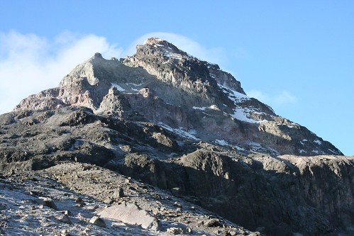
After finally escaping the Quito vortex, we headed south to the little town of Chaupi which sits just under the Illinizas. Chaupi has a nice climber’s hostel, hostal Llovizna, with hot water, several rooms, good food, ping-pong, and a pool table! (even if the cues don’t have felt tips on them). We unloaded our stuff, and got ready for the approach tomorrow morning. Three British climbers soon arrived at the hostel that had just come down from Illiniza Sur. We drank beer and played pool while they told us about the climb. It was great to get such current information about snow and ice conditions and route finding difficulties. That night, we took a walk around the small central square of Chaupi and saw our new friends in a restaurant/bar/pool room. Rod went to get a glass of the local liquor, aguardiente, but he accidentally purchased a whole bottle it, peach flavored (his Spanish has gotten much better since). So, everyone ended up getting a little more shnockerd than planned, including the waiter, who we kept serving shots to each time he came to the table.
Next morning we drove up the rutted out dirt road to the Illiniza trail head, then plodded our way up the long moraine ridge to the refugio nestled just below the col between the two mountains.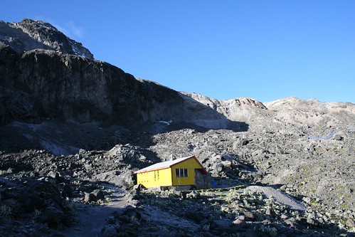 This refugio was smaller, and dirtier than the one on Cotopaxi, but did have two gas stoves and a gas lantern. The peak of Illiniza sur was covered with clouds as we hiked up to the col between the mountains and did a little route pre-inspection. Illiniza norte was not clouded over, however, and we were awed by the colors of the peak, its ruggedness, and the beautiful green lake at its base. I practiced some yoga and aikido movements in the meadow next to the refuge before dinner, then again to bed early with a wake up time set for 2:15am.
Up and Out and Up. The route finding in the dark for the normal route up Illiniza sur was the most difficult part. We headed up to the col, then up the moraine. We went over the moraine and down into the obvious drainage, then followed that to drop down onto the glacier. We got a bit lost here because we were hesitant to keep following the glacier down. It is quite a ways. We were looking for a ramp up the rock cliff/ridge too early. We found on the return that you can stay up on the moraine (don’t follow the cairns into the drainage between the mountain and the moraine) and follow it’s ridge down to where you can just cross the glacier to the ramp up the rock cliff/ridge. However, if you keep walking down the glacier between the moraine and the rock cliff/ridge, you will get to the ramp up and onto the cliff/ridge, and maybe this is easier travel. Once up the ramp, we moved around the corner and up a short class 4 scramble to gain the ridge. Then it was just a walk strait up to the snowfield.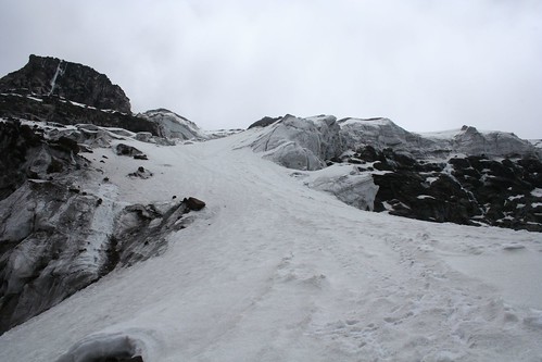
 We approached the snow field from high up on the climbers left side because this avoided some ice fields at the base of this glacier. Once on the snow, the route was obvious.
 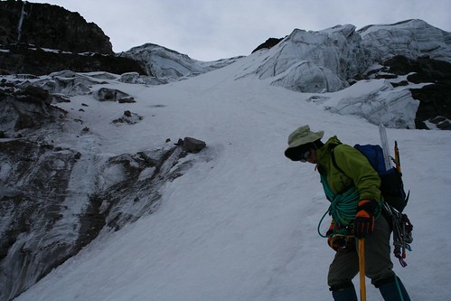 It begins with a long steepish (~45-50 degree) pitch that has some crevasses at the top where the slope shallows with thin (almost alarming) snow bridges. Then the route turns slightly climbers right until you reach the crux of the climb, 100m of steep snow/ice above a small crevasse. We climbed this pitch traditionally, setting pro and belaying from an anchor at the top. The belay at the top of it was really cool! It was sitting on a narrow ridge of snow that dropped on the other side into one of the biggest, deepest crevasse I have ever seen. After this, the route moves to the climbers left and up the snowfield toward the large rocky outcrop near the summit. From the base of the rocky outcrop, we could see the summit to the right. What a crazy funky summit! It is just a massive ice block, one with the strangest textures and formations on it. A hulking, bulbous, icicle, sasquatch hiding, chunk of ice sitting on the top of a mountain. Crazy!
 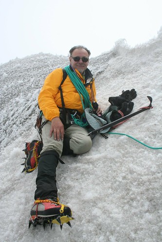 We followed the ice/snow ridge up and around climbers’ right to the summit (5245 m, 17,308 feet).
Illiniza Norte and Illiniza Sur make up the peaks known as the Illinizas. A long long time ago, the son of a local leader, and the daughter of a rival leader fell in love. The boys’ father was not happy about this, and he hired a wizard to take care of the situation. The wizard took the girl and using powerful magic, he turned her to stone. He turned her into Illiniza Norte. Now the boy was devastated. He did not know what
happened to his love. He abandoned his father and set out looking for her. For years he traveled up and down the paramo, searching and telling people his story. One day he came across a wizard, the same wizard who had turned his love into Illiniza Norte. With much pleading, the wizard finally agreed to give the boy his wish. Using powerful magic, he turned him into Illiniza Sur, so that the two lovers could always be together.Like the story says, the Illinizas are two mountains that have a real aura of magic about them. Illiniza Norte is gentile and beautiful. Her colors of red, yellow, orange, white, and black constantly changing and emerging with the light. Illiniza Sur is more hidden, and fiercer, but he sparkles and shines amazingly. Illiniza Sur is considered one of the most difficult and technical climbs in Ecuador.
After finally escaping the Quito vortex, we headed south to the little town of Chaupi which sits just under the Illinizas. Chaupi has a nice climber’s hostel, hostal Llovizna, with hot water, several rooms, good food, ping-pong, and a pool table! (even if the cues don’t have felt tips on them). We unloaded our stuff, and got ready for the approach tomorrow morning. Three British climbers soon arrived at the hostel that had just come down from Illiniza Sur. We drank beer and played pool while they told us about the climb. It was great to get such current information about snow and ice conditions and route finding difficulties. That night, we took a walk around the small central square of Chaupi and saw our new friends in a restaurant/bar/pool room. Rod went to get a glass of the local liquor, aguardiente, but he accidentally purchased a whole bottle it, peach flavored (his Spanish has gotten much better since). So, everyone ended up getting a little more shnockerd than planned, including the waiter, who we kept serving shots to each time he came to the table.
Next morning we drove up the rutted out dirt road to the Illiniza trail head, then plodded our way up the long moraine ridge to the refugio nestled just below the col between the two mountains.
This refugio was smaller, and dirtier than the one on Cotopaxi, but did have two gas stoves and a gas lantern. The peak of Illiniza sur was covered with clouds as we hiked up to the col between the mountains and did a little route pre-inspection. Illiniza norte was not clouded over, however, and we were awed by the colors of the peak, its ruggedness, and the beautiful green lake at its base. I practiced some yoga and aikido movements in the meadow next to the refuge before dinner, then again to bed early with a wake up time set for 2:15am.Up and Out and Up. The route finding in the dark for the normal route up Illiniza sur was the most difficult part. We headed up to the col, then up the moraine. We went over the moraine and down into the obvious drainage, then followed that to drop down onto the glacier. We got a bit lost here because we were hesitant to keep following the glacier down. It is quite a ways. We were looking for a ramp up the rock cliff/ridge too early. We found on the return that you can stay up on the moraine (don’t follow the cairns into the drainage between the mountain and the moraine) and follow it’s ridge down to where you can just cross the glacier to the ramp up the rock cliff/ridge. However, if you keep walking down the glacier between the moraine and the rock cliff/ridge, you will get to the ramp up and onto the cliff/ridge, and maybe this is easier travel. Once up the ramp, we moved around the corner and up a short class 4 scramble to gain the ridge. Then it was just a walk strait up to the snowfield.
We approached the snow field from high up on the climbers left side because this avoided some ice fields at the base of this glacier. Once on the snow, the route was obvious. It begins with a long steepish (~45-50 degree) pitch that has some crevasses at the top where the slope shallows with thin (almost alarming) snow bridges. Then the route turns slightly climbers right until you reach the crux of the climb, 100m of steep snow/ice above a small crevasse. We climbed this pitch traditionally, setting pro and belaying from an anchor at the top. The belay at the top of it was really cool! It was sitting on a narrow ridge of snow that dropped on the other side into one of the biggest, deepest crevasse I have ever seen. After this, the route moves to the climbers left and up the snowfield toward the large rocky outcrop near the summit. From the base of the rocky outcrop, we could see the summit to the right. What a crazy funky summit! It is just a massive ice block, one with the strangest textures and formations on it. A hulking, bulbous, icicle, sasquatch hiding, chunk of ice sitting on the top of a mountain. Crazy! We followed the ice/snow ridge up and around climbers’ right to the summit (5245 m, 17,308 feet).
Friday, February 16, 2007
Mt Cotopaxi
Cotopaxi: 2/6,7/2007
Taita Cotopaxi, or father Cotopaxi, is the highest active volcano and most sacred site of the Quichua peoples of Ecuador.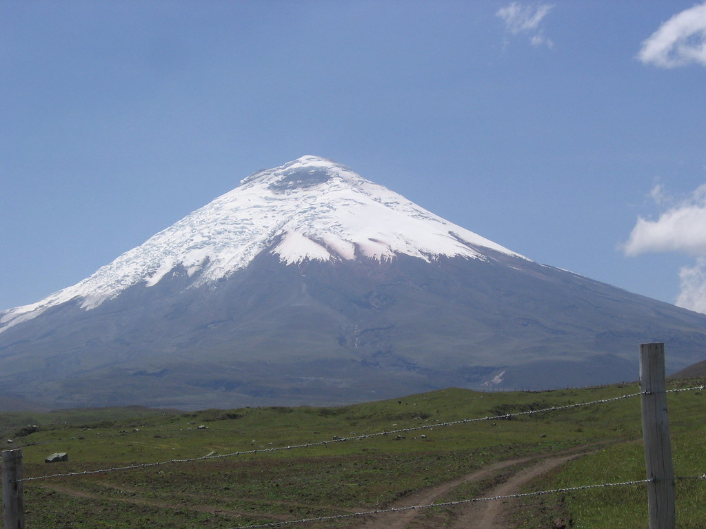 A beautiful, almost perfect cone, Cotopaxi is easily identified and visible from most high spots in the northern Ecuadorian paramo. It has erupted many times in the last 200 years, and looks like it could blow at any moment. [5897 m, 19,460 feet]
Luis, our driver from Quito, picked us up early and made a swerving, jerky, gripping drive toward the Cotopaxi National Park. Near the park, he introduced us to a beautiful Hacienda (Hacienda El Porvenir ?) where we were greeted with a delicious local tea with aguardiente (fire water – the local alcohol of choice). We ended up staying for lunch, and scheduled someone from the Hacienda to pick us up the next day, midday, at the Cotopaxi trailhead. Luis then continued the bumpy, white knuckle drive up to the Cotopaxi trailhead. We unloaded the gear and began the slow hike up to the refugio. From there the normal route to the summit begins.
The refugio was much nicer than expected; clean, big, had electricity, lots of bunks, big kitchen. Over the course of the afternoon several other groups of climbers arrived there. We bunked near a friendly group (guy from New Zealand, an English woman, and an American) and shared stories of travels while everyone played with Rod’s blood oxygen meter. After a short hike scouting the trail, we prepared and ate dinner (the refugio even had beer for sale!). Then, at 6:00, we lay down and attempted to get some sleep. The wake up time – alpine style – will be midnight. Sleeping is not so easy at 15,000 feet, and then add in a raucous group of French climbers who apparently had no interest in sleeping when beer was available (of course all the French climbers made it to the summit).
At midnight, everyone in the refugio was up, eating breakfast, and preparing for the climb. All the groups started around the same time, and were close together for the beginning of the climb. Then as time passed the groups spread out more and more. We were the slowest group, carefully bringing up the rear. Our strategy is to go slow and steady, especially at the beginning, so that fatigue and exertion don’t play a role in potential altitude sickness. After gaining the glacier, it was just a long steep slog up and up.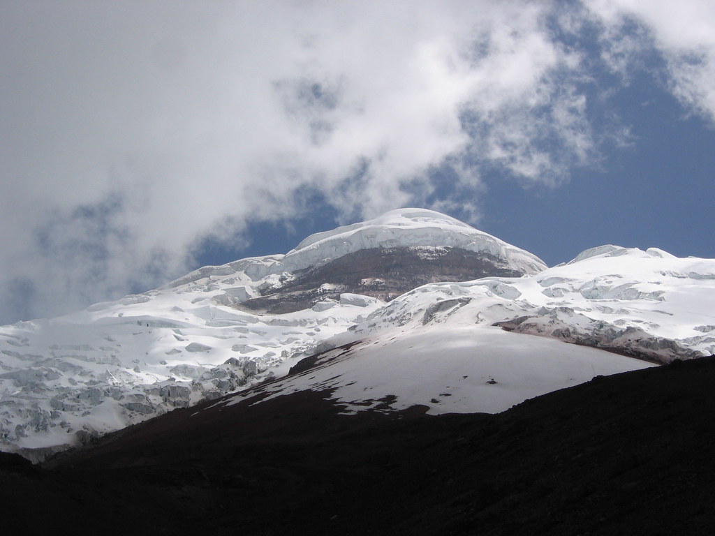 The glacier had minimal crevasses, and the snow cover was stable. It was technically easy… just at an altitude higher than we had ever been. On the way up, we passed two groups of climbers that were coming down because of altitude sickness. Both groups had started out at a really fast pace. At dawn, we were at about 5000 m, and were very optimistic about reaching the summit. Our pace had been good, we were feeling energetic still, and now, we could see! The wind at this altitude was very cold, but the rising sun was warming things up slightly. A kind of high
 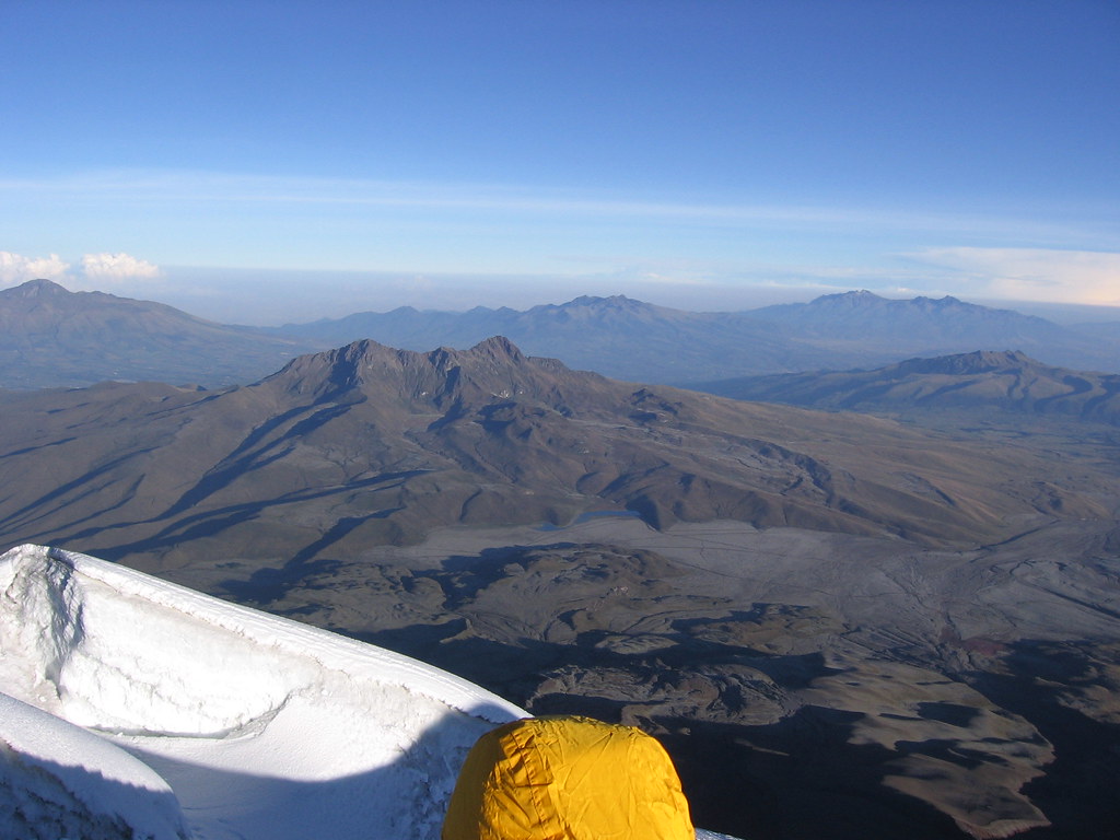 altitude-fatigue-ecstasy filled me as the sun started to climb with us; it was an amazing joy filled clarity that is indescribable, yet defiantly unforgettable.
We continued up to the climbs’ difficulty crux, a thick snow bridge over a crevasse and up the short steep snow covered crevasse wall on the other side. It was easy though, because a boot pack was already in place. At the top of this, we were in a small gully that acted like a wind tunnel. The wind was fierce and COLD. Rod started to slow down in the gully, and as we were heading up the pitch that would bring us out of the gully and onto the last push to the summit, Rod felt his energy level plummet; drop in half.
  One of the first signs of altitude sickness. With the pace cut in half, I was getting too cold in the wind, and ability to reach the summit early enough in the day was in question. At 5300m we gave thanks to the spirit of Cotopaxi for the beautiful climb, and turned around.
Of course, the walk down was horrendous and long. But rewardingly, as we approached the refugio, we saw two Andean wolfs in the rocks (they are very shy and have big bushy tails), and flying over head, a Condor! The Condor is very sacred to the Quichua, the native people who are descendents of the Inca. The Condor is the messenger between the people and gods Pachamama and Pachakamak. Pachamama is the feminine spirit of fertility who regulates the seasons and the entire natural world (earth mother). Pachakamak is the masculine spirit of creation who protects and cares for the universe (sun father).
After we grabbed our stuff at the refugio and made it to the trail head, a driver was ready to take us to the Hacienda.
 The rooms there are very comfortable and pleasant, and the food was great. Our waiter was a local native man, dressed in poncho and all, who really enjoyed telling us about the animals and plants in the area. Where condor nests were, how the pumas had taken some sheep recently, all his favorite potatoes, and the plants used to make the good teas served with each meal. While we were there, we watched the men fix the grass roofing over one of the barns. They just took handfuls of new grass, lifted up the old grass already on the roof, and pushed the new grass in. They worked across the roof slope and from bottom to top. How they didn’t slide off the roof, I’ll never know. The next day, Luis picked us up and took us back to Quito.
Taita Cotopaxi, or father Cotopaxi, is the highest active volcano and most sacred site of the Quichua peoples of Ecuador.
A beautiful, almost perfect cone, Cotopaxi is easily identified and visible from most high spots in the northern Ecuadorian paramo. It has erupted many times in the last 200 years, and looks like it could blow at any moment. [5897 m, 19,460 feet]Luis, our driver from Quito, picked us up early and made a swerving, jerky, gripping drive toward the Cotopaxi National Park.
Near the park, he introduced us to a beautiful Hacienda (Hacienda El Porvenir ?) where we were greeted with a delicious local tea with aguardiente (fire water – the local alcohol of choice). We ended up staying for lunch, and scheduled someone from the Hacienda to pick us up the next day, midday, at the Cotopaxi trailhead. Luis then continued the bumpy, white knuckle drive up to the Cotopaxi trailhead. We unloaded the gear and began the slow hike up to the refugio. From there the normal route to the summit begins.The refugio was much nicer than expected; clean, big, had electricity, lots of bunks, big kitchen. Over the course of the afternoon several other groups of climbers arrived there. We bunked near a friendly group (guy from New Zealand, an English woman, and an American) and shared stories of travels while everyone played with Rod’s blood oxygen meter. After a short hike scouting the trail, we prepared and ate dinner (the refugio even had beer for sale!). Then, at 6:00, we lay down and attempted to get some sleep. The wake up time – alpine style – will be midnight. Sleeping is not so easy at 15,000 feet, and then add in a raucous group of French climbers who apparently had no interest in sleeping when beer was available (of course all the French climbers made it to the summit).
At midnight, everyone in the refugio was up, eating breakfast, and preparing for the climb. All the groups started around the same time, and were close together for the beginning of the climb. Then as time passed the groups spread out more and more. We were the slowest group, carefully bringing up the rear. Our strategy is to go slow and steady, especially at the beginning, so that fatigue and exertion don’t play a role in potential altitude sickness. After gaining the glacier, it was just a long steep slog up and up.
The glacier had minimal crevasses, and the snow cover was stable. It was technically easy… just at an altitude higher than we had ever been. On the way up, we passed two groups of climbers that were coming down because of altitude sickness. Both groups had started out at a really fast pace. At dawn, we were at about 5000 m, and were very optimistic about reaching the summit. Our pace had been good, we were feeling energetic still, and now, we could see! The wind at this altitude was very cold, but the rising sun was warming things up slightly. A kind of high altitude-fatigue-ecstasy filled me as the sun started to climb with us; it was an amazing joy filled clarity that is indescribable, yet defiantly unforgettable.We continued up to the climbs’ difficulty crux, a thick snow bridge over a crevasse and up the short steep snow covered crevasse wall on the other side.
It was easy though, because a boot pack was already in place. At the top of this, we were in a small gully that acted like a wind tunnel. The wind was fierce and COLD. Rod started to slow down in the gully, and as we were heading up the pitch that would bring us out of the gully and onto the last push to the summit, Rod felt his energy level plummet; drop in half. One of the first signs of altitude sickness. With the pace cut in half, I was getting too cold in the wind, and ability to reach the summit early enough in the day was in question. At 5300m we gave thanks to the spirit of Cotopaxi for the beautiful climb, and turned around.Of course, the walk down was horrendous and long. But rewardingly, as we approached the refugio, we saw two Andean wolfs in the rocks (they are very shy and have big bushy tails), and flying over head, a Condor! The Condor is very sacred to the Quichua, the native people who are descendents of the Inca. The Condor is the messenger between the people and gods Pachamama and Pachakamak. Pachamama is the feminine spirit of fertility who regulates the seasons and the entire natural world (earth mother). Pachakamak is the masculine spirit of creation who protects and cares for the universe (sun father).
After we grabbed our stuff at the refugio and made it to the trail head, a driver was ready to take us to the Hacienda.
The rooms there are very comfortable and pleasant, and the food was great. Our waiter was a local native man, dressed in poncho and all, who really enjoyed telling us about the animals and plants in the area. Where condor nests were, how the pumas had taken some sheep recently, all his favorite potatoes, and the plants used to make the good teas served with each meal. While we were there, we watched the men fix the grass roofing over one of the barns. They just took handfuls of new grass, lifted up the old grass already on the roof, and pushed the new grass in. They worked across the roof slope and from bottom to top. How they didn’t slide off the roof, I’ll never know. The next day, Luis picked us up and took us back to Quito. Thursday, February 15, 2007
Mt Fuya Fuya
Fuya Fuya: 2/5/2007
We drove out of Quito on the Pan Americana heading north to the lago _____. Its beautiful blue water fills a crater ringed with rocky peaks that overlook the town of Otavalo.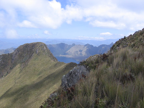 Mt Fuya Fuya is ~14,000 ft and the acclimatization hike will prepare us for climbing Cotopaxi. On the way to Fuya Fuya, as we passed through little towns, the roads were lined with stands selling all sorts of unknowns. We stopped to try some funky tropical fruits that we had not seen before. One fruit is round and almost scaled on the outside. You just tear it into two parts and the center is filled with delicious white flesh, and large round glossy black seeds. Another super tasty fruit looks like a giant bean pod, like a fava bean pod on steroids (2.5 feet long). This one is filled with black bean/seeds surrounded by pink flesh that you suck off the bean. Yummy! I don’t know what the name of either fruit is. On the drive, we also passed the equator, we moved from the southern hemisphere to the northern, and the line was marked on the road. Interestingly, the people of this region north of the equator, unlike other parts of Ecuador, have made an effort to value and market their native culture. They have successfully built a system of community controlled income exporting woven items and other native crafts. This has allowed them to actively preserve their culture while functioning in the broader capitalist system. Most people here dress in the native cloths, and the houses and towns are cleaner and have less abandoned buildings.
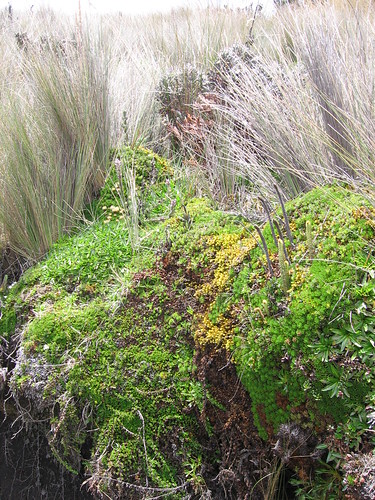
The climb up Fuya Fuya was eye opening. This was the first time we walked in the ‘paramo’, the altiplano, the Andean highland grasslands. It was a botany adventure. We passed through a broad slope populated primarily by large bunch grasses, with an occasional Achupalla, Puya clava-herculis (looks like a century plant),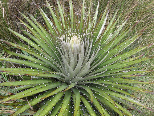 or Chuquirahua bush, Chuquiraga jussieui. The Chuquirahua was recommended to me by a local as a medicinal. Make a tea of it and it helps the stomach and intestinal or menstrual cramps. As we climbed toward the summit, the terrain became rocky and the plants diversified.
  So many beautiful plants that I had never seen, or even imagined. I had to stop and take a photo every two seconds it seemed. It was amazing! After the hike down, we drove back to Quito to pack up our gear for climbing Cotopaxi tomorrow.

We drove out of Quito on the Pan Americana heading north to the lago _____. Its beautiful blue water fills a crater ringed with rocky peaks that overlook the town of Otavalo.
Mt Fuya Fuya is ~14,000 ft and the acclimatization hike will prepare us for climbing Cotopaxi. On the way to Fuya Fuya, as we passed through little towns, the roads were lined with stands selling all sorts of unknowns. We stopped to try some funky tropical fruits that we had not seen before. One fruit is round and almost scaled on the outside. You just tear it into two parts and the center is filled with delicious white flesh, and large round glossy black seeds. Another super tasty fruit looks like a giant bean pod, like a fava bean pod on steroids (2.5 feet long). This one is filled with black bean/seeds surrounded by pink flesh that you suck off the bean. Yummy! I don’t know what the name of either fruit is. On the drive, we also passed the equator, we moved from the southern hemisphere to the northern, and the line was marked on the road. Interestingly, the people of this region north of the equator, unlike other parts of Ecuador, have made an effort to value and market their native culture. They have successfully built a system of community controlled income exporting woven items and other native crafts. This has allowed them to actively preserve their culture while functioning in the broader capitalist system. Most people here dress in the native cloths, and the houses and towns are cleaner and have less abandoned buildings.The climb up Fuya Fuya was eye opening. This was the first time we walked in the ‘paramo’, the altiplano, the Andean highland grasslands. It was a botany adventure. We passed through a broad slope populated primarily by large bunch grasses, with an occasional Achupalla, Puya clava-herculis (looks like a century plant),
or Chuquirahua bush, Chuquiraga jussieui. The Chuquirahua was recommended to me by a local as a medicinal. Make a tea of it and it helps the stomach and intestinal or menstrual cramps. As we climbed toward the summit, the terrain became rocky and the plants diversified. So many beautiful plants that I had never seen, or even imagined. I had to stop and take a photo every two seconds it seemed. It was amazing! After the hike down, we drove back to Quito to pack up our gear for climbing Cotopaxi tomorrow. Wednesday, February 14, 2007
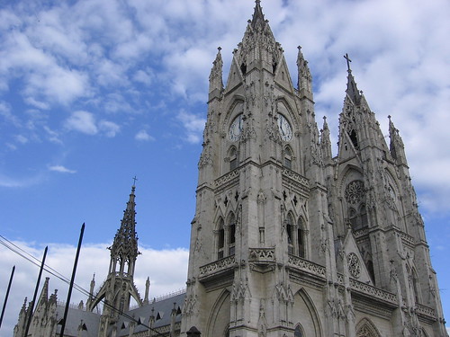
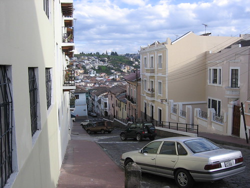
Quito Vortex


Quito is a surprisingly beautiful city. It fills a valley surrounded by steep, tall, green hills. The elevation (9,000 ft) makes the weather very comfortable despite its location basically on the equator. The architecture, decor in restaurants, shops, and hotels, and prolific artwork are impressive. 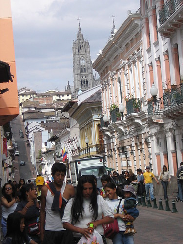 Similarly, the bureaucracy, red tape, and corruption are outstanding.
Similarly, the bureaucracy, red tape, and corruption are outstanding. We arrived in Quito thinking it would take 2-3 days to find and buy a used truck. We would then leave the city and begin a 3.5 month road trip through Equador, Peru, Bolivia, and Chile.
We also had to quickly pick up our mail. We had some gear and supplies shipped to Quito from California. It all seemed so simple... little did we know about the Quito Vortex.
Day 1: After checking into the very nice Hotel Los Alpes, we were given the address where our mail was being kept. 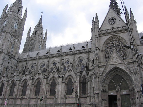 When we got there, they said that we will have to pay $450 for customs. (the mail was some used books, a camera and lenz, and some sees suckers). We didn't pay and said we would come back tomorrow.
When we got there, they said that we will have to pay $450 for customs. (the mail was some used books, a camera and lenz, and some sees suckers). We didn't pay and said we would come back tomorrow.Day 2: We went looking for cars to buy, found one but the price was not negotiable, so we kept looking. The mail was settled by giving the customs agent $200 (which he pocketed), and just accepting the loss.
Day 3: ...
... to be finished later ...
Saturday, February 3, 2007
Volcan Irazu
Costa Rica (1/25-2/1) and Volcan Irazu - 1/30/2007
Costa Rica
Green canopies, beans and rice, jungle, volcanoes, cloud forest, crocodiles, humid, black sand, big eared cows, coffee, more coffee. Our time in Costa Rica was full of all these things, and was a great resting period before the big peaks of South America.
After a arriving in San Jose, Rod and I set off in very tiny, and very tightly packed, rental car for the beach. The roads in Costa Rica aren´t named or labeled. You just have to hope you see a sign with the next village´s name on it and head that way, or ask people from village to village. Needless to say we got lost.
After hours of diving, and a 1.5 hr wait on a dirt road for some road repair to get finished, Rod and I were hungry, irritable, and still hours from the beach. As proof that miracles do happen, we came around a curve in the road and saw a small sign for a hotel. We drove in and found ourselves greeted by two very friendly American owners (Jill and Bob) who not only had a room available, but said that dinner is just about to be served! Hurray! Turns out, Jill is an herbalist, healer, and great jazz vocalist, and Bob is retired from the music industry. Among the other guests was a old time jazz guitarist from New Orleans, and a superb clarinet player. Feeling better after the meal, Rod and I enjoyed some great live jazz from the sofa! Hurray! With morning yoga on the sundeck, an excellent breakfast, and some directions from Bob, Rod and I headed out again seeking the beach. Yup, I like Costa Rica so far!
(The hotel is AmaTierra Hotel and Retreat http://www.amatierra.com/index.html)
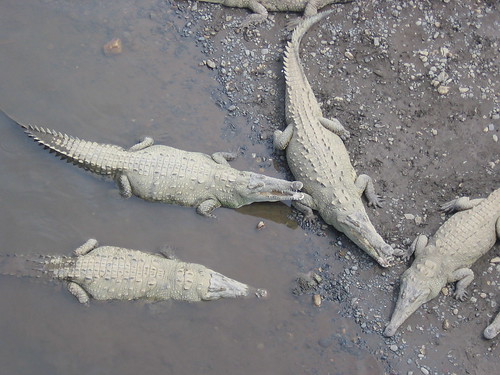 We made it to Jaco, a busy beach town on the Pacific side. Here we spent two days and enjoyed the beach, surfing, and crocodile viewing. On our way back into the central valley we took a short hike through the lush jungle and saw monkeys, lots of birds, crocodiles, and other funky looking lizards. We then headed up in elevation to the town of Cartago, intending to get a early start up Volcan Irazu the next morning.
Volcan Irazu (3402 m, 11,260 ft)-
The name Irazu (or Iztaru) is derived from the Huatare Indian language and means "a thunder", or "the place which trembles". This mountain was a sacred center point for pre-Colombian native peoples, and is today also cloaked in stories of UFO sightings and an alien subterranean facility (The Costa Rican Shasta!). Irazu, is the home of Thunder.
At the summit are three overlapping craters, whose lunar landscape contrasts starkly with the thick foliage of the mountainsides. It is sort of an alien space.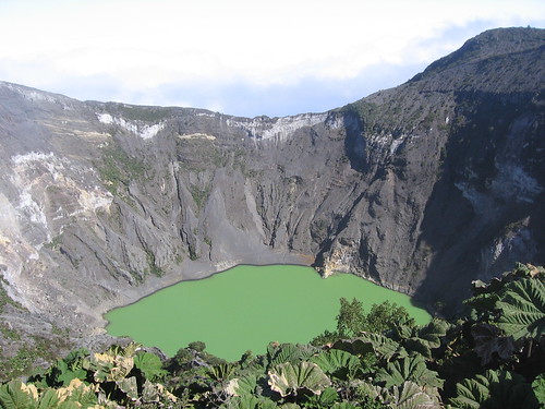 The main crater is 300 m deep and 1050 m across, with the oddest olive-green-glow-in-the-dark color lake at the bottom. The volcano is still active, with the last major eruption in 1963. It covered Cartago and San Jose in a thick layer of ash. Today Irazu is in a National Park, and has a road up to the craters and a little cafe near the summit (now that´s mountaineering!).
Because of the daily ritual of a clear morning atop the mountain, then clouds encasing everything around 10:00 am, we started out early. The slopes of Irazu are very fertile, and the road up passes through fields of coffee, potato, chayote (a vegetable), onions, and cow pasture. While passing through the little farming villages you might get stopped to allow some cows to cross, or see a man walking a horse loaded with fresh milk jugs. The crisp clear morning sunshine made the place magical.
When we got to the National Park entrance at 7:20, of course the gate was locked (opens at 8:00).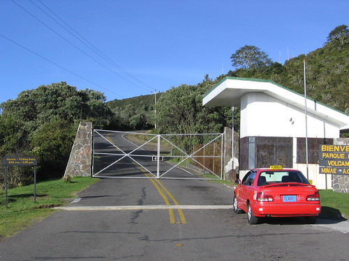 We thought we would just walk around the gate and up to the summit, but there was no way through the barbed wire and trenches that surrounded the gate! They are serious about getting their National Park fee. At 8, we drove up to the end of the road and walked to the summit. It is said that on a clear day, the top of Irazu is the only place in the world where you can see the Pacific and Atlantic ocean (Caribbean sea) at the same time. We could see the Pacific, but the area below us to the east was covered with clouds. We made an offering to Thunder on the summit, then walked into the craters. We had great sunny views, but could see the clouds rising up the southeast side of the mountain and spilling into the craters as we stood there. Like clock work, at about 10:00 am, the whole place was in the clouds.
With more than half the day left, Rod and I drove for lunch to the Orosi Valley. The river flowing down the center of the valley is lined on both sides with rows of coffee plants under a thin overstory of trees. Like a tropical coffee Napa! The lush and colorful mountain sides surrounding the valley had terraced banana plantations, and trees with a full canopy of bright orange leaves. We drank some excellent coffee, and then... we drank some more.
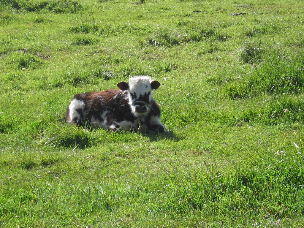
In the afternoon, we drove through the cloud forest over the Cerro de la Muerte to a very pleasant little jungle mountain town along the Rio Blanco, and at the foot of Costa Rica´s tallest mountain, Cerro Chirripo (3819 m). The next morning we took a sweaty hike up through the jungle. We didn´t see much wildlife (except big ear cows).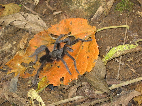 And just when we were making jokes about the homicidal psycho jungle tigers stalking us, and other wildlife we were not seeing, I almost stepped on the biggest, blackest, tarantula-est crossing the trail. All the tingles behind the ears! After that we took our romp through the jungle a lot more seriously.
Done with the hike, we hit the local hot spring for a dip before heading back to the beautiful lazy Orosi Vally. The next day, with a serious coffee buzz, it was back to San Jose to fly out the following day. Asta luego! Love ya Costa Rica!
Costa Rica
Green canopies, beans and rice, jungle, volcanoes, cloud forest, crocodiles, humid, black sand, big eared cows, coffee, more coffee. Our time in Costa Rica was full of all these things, and was a great resting period before the big peaks of South America.
After a arriving in San Jose, Rod and I set off in very tiny, and very tightly packed, rental car for the beach. The roads in Costa Rica aren´t named or labeled. You just have to hope you see a sign with the next village´s name on it and head that way, or ask people from village to village. Needless to say we got lost.
After hours of diving, and a 1.5 hr wait on a dirt road for some road repair to get finished, Rod and I were hungry, irritable, and still hours from the beach. As proof that miracles do happen, we came around a curve in the road and saw a small sign for a hotel. We drove in and found ourselves greeted by two very friendly American owners (Jill and Bob) who not only had a room available, but said that dinner is just about to be served! Hurray! Turns out, Jill is an herbalist, healer, and great jazz vocalist, and Bob is retired from the music industry. Among the other guests was a old time jazz guitarist from New Orleans, and a superb clarinet player. Feeling better after the meal, Rod and I enjoyed some great live jazz from the sofa! Hurray! With morning yoga on the sundeck, an excellent breakfast, and some directions from Bob, Rod and I headed out again seeking the beach. Yup, I like Costa Rica so far!
(The hotel is AmaTierra Hotel and Retreat http://www.amatierra.com/index.html)
We made it to Jaco, a busy beach town on the Pacific side. Here we spent two days and enjoyed the beach, surfing, and crocodile viewing. On our way back into the central valley we took a short hike through the lush jungle and saw monkeys, lots of birds, crocodiles, and other funky looking lizards. We then headed up in elevation to the town of Cartago, intending to get a early start up Volcan Irazu the next morning.Volcan Irazu (3402 m, 11,260 ft)-
The name Irazu (or Iztaru) is derived from the Huatare Indian language and means "a thunder", or "the place which trembles". This mountain was a sacred center point for pre-Colombian native peoples, and is today also cloaked in stories of UFO sightings and an alien subterranean facility (The Costa Rican Shasta!). Irazu, is the home of Thunder.
At the summit are three overlapping craters, whose lunar landscape contrasts starkly with the thick foliage of the mountainsides. It is sort of an alien space.
The main crater is 300 m deep and 1050 m across, with the oddest olive-green-glow-in-the-dark color lake at the bottom. The volcano is still active, with the last major eruption in 1963. It covered Cartago and San Jose in a thick layer of ash. Today Irazu is in a National Park, and has a road up to the craters and a little cafe near the summit (now that´s mountaineering!).Because of the daily ritual of a clear morning atop the mountain, then clouds encasing everything around 10:00 am, we started out early. The slopes of Irazu are very fertile, and the road up passes through fields of coffee, potato, chayote (a vegetable), onions, and cow pasture. While passing through the little farming villages you might get stopped to allow some cows to cross, or see a man walking a horse loaded with fresh milk jugs. The crisp clear morning sunshine made the place magical.
When we got to the National Park entrance at 7:20, of course the gate was locked (opens at 8:00).
We thought we would just walk around the gate and up to the summit, but there was no way through the barbed wire and trenches that surrounded the gate! They are serious about getting their National Park fee. At 8, we drove up to the end of the road and walked to the summit. It is said that on a clear day, the top of Irazu is the only place in the world where you can see the Pacific and Atlantic ocean (Caribbean sea) at the same time. We could see the Pacific, but the area below us to the east was covered with clouds. We made an offering to Thunder on the summit, then walked into the craters. We had great sunny views, but could see the clouds rising up the southeast side of the mountain and spilling into the craters as we stood there. Like clock work, at about 10:00 am, the whole place was in the clouds.With more than half the day left, Rod and I drove for lunch to the Orosi Valley. The river flowing down the center of the valley is lined on both sides with rows of coffee plants under a thin overstory of trees. Like a tropical coffee Napa! The lush and colorful mountain sides surrounding the valley had terraced banana plantations, and trees with a full canopy of bright orange leaves. We drank some excellent coffee, and then... we drank some more.
In the afternoon, we drove through the cloud forest over the Cerro de la Muerte to a very pleasant little jungle mountain town along the Rio Blanco, and at the foot of Costa Rica´s tallest mountain, Cerro Chirripo (3819 m). The next morning we took a sweaty hike up through the jungle. We didn´t see much wildlife (except big ear cows).
And just when we were making jokes about the homicidal psycho jungle tigers stalking us, and other wildlife we were not seeing, I almost stepped on the biggest, blackest, tarantula-est crossing the trail. All the tingles behind the ears! After that we took our romp through the jungle a lot more seriously.Done with the hike, we hit the local hot spring for a dip before heading back to the beautiful lazy Orosi Vally. The next day, with a serious coffee buzz, it was back to San Jose to fly out the following day. Asta luego! Love ya Costa Rica!
Subscribe to:
Posts (Atom)