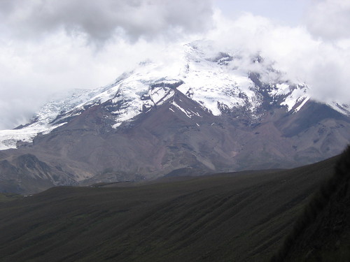
Chimborazo: 2/16,17,18/2007
Chimborazo was in love with Tungurahua, the slender, tall, fiery, and explosive volcano to the east. But some other mountains were courting her too. Mt. Altar and Mt. Carihuairazo each also wanted Tungurahua as his wife. They all thought she was Hot! Chimborazo is a very big guy. He decided to bash the heads in of his rivals. He beat up Altar, so now Altar’s summit is a massive blown out crater ringed by a number of jagged, rocky pinnacles. He beat up Carihuairazo. His summit is now just a thin pointy block of rock. After taking care of her other suitors, he and Tungurahua got married.
Chimborazo is indeed a MASSIVE mountain.
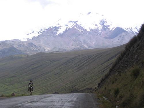 6270 m, or 20,670 feet tall, for many years it was thought to be the tallest mountain on Earth. It turns out that the summit of Chimborazo is the point on earth closest to the Sun. How can this be? What about the Himalayas? Chimborazo’s latitude is very close to the equator, and remember that Earth has an equatorial bulge. If you measure altitude from sea level, the mountain is 6270 m, but if you measure the altitude as distance from the center of Earth, it is the tallest mountain in the world; closest to the sun. And for the Quechua people, the descendents of the children of the Sun, this is a very sacred place.
We hired a local guide for our Chimborazo attempt. The logistics of getting to the mountain refuge and route finding were made a lot easier having someone who knows the terrain with us. We all squeezed into the truck in Los Banos and drove 3 hours up to the Carrel Refugio (4850 m) on the SW face. Because it is a dry year, and the glaciers are receding rapidly. The approach from the Whimper Refugio, climbing the Normal Route, had too much rock fall and bad ice. We decided on a route that followed a ridge to the east of the Normal Route, up to the Castillo (a prominent rock and landmark), then continued on the ridge to gain the glacier, then followed the normal route from there. And we decided to do it in two parts, using a high camp at the Castillo. We thought this would be better for successful acclimatization.
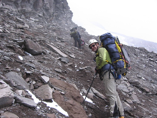
After arriving at the Carrel Refugio and deciding on our plan, we packed up our high camp gear and trekked up to the ridge that leads to the Castillo. It was starting to snow and get icy, so we left our stuff there under a tarp and headed back to the Refugio. There was no need to get up early in the morning, so we spent the evening having a leisurely dinner and playing cards. The next day was Rod’s birthday! In the morning we had a candle in his breakfast and sang happy birthday. Then we packed up our sleeping bags and few other things, and headed up to make high camp. We picked up our bags we left the day before, and continued up the ridge. Soon, we had to head climber’s right and traverse under the rock formations on the ridge. This was a hard, slippery, steep, loose, long, tedious, hell-walk!
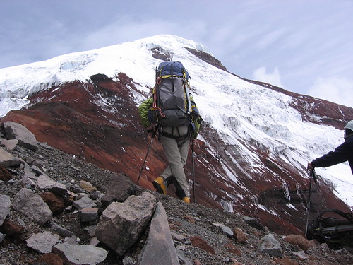 But we finally made it past the cliffs and back onto the ridge, right at the Castillo. We set up camp on top of the Castillo,
 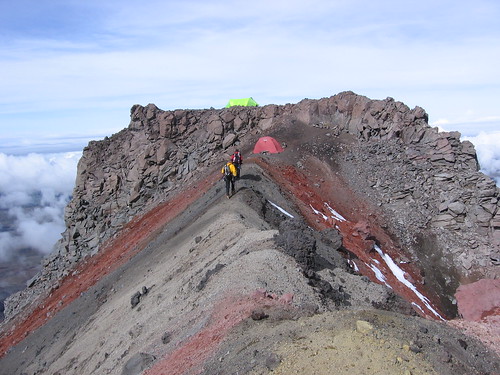 and had a beautiful warm sunny afternoon looking over the clouds.
 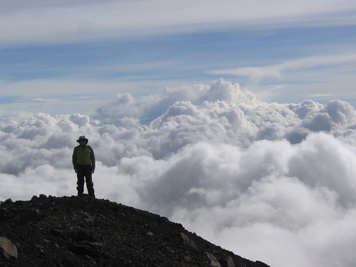 A nice birthday for Rod. We ate dinner early, and went to sleep at 6:00… wake up time, 11:30pm.
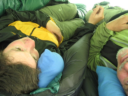
We got up on time, ate some breakfast, packed our climbing packs and started up. The crux of the climb is right at the beginning. To gain the glacier, we had to cross some very exposed rock covered ice, then climb a steep pitch of normal ice. The rock covered ice was really tricky because it looked just like loose gravel, but it was gravel frozen on top of, or cemented by, ice that was not visible. It was very hard, and difficult to protect. We climbed it on belay with ice axes and crampons. Then to the steep pitch of ice… we climbed this setting ice screws and a belay anchor at the top.
 Now that we are up onto the glacier, the rest is just one long, long, long, seemingly endless slog to the top. We walked, and walked. And all of a sudden, the ground started to level, and we were walking around on the Veintimilla summit! WhooHooo! Standing on the closest point to the sun, the summit of Chimborazo!
Chimborazo has several different summits that are approached from different routes. But at the top, it is all pretty much level, the summits are only one or tow hundred feet or so different in height. The highest summit is about 1 km east of the Veintimilla summit across the summit plateau (1/2 hr walk in good conditions). Because it has been a dry year in Ecuador, the summit plateau was riddled with crevasses and seracs instead of being all smooth and covered with snow. We searched for a way to cross the icy jumble to gain the main summit, but it was just a mess up there. So we hung out on the Veintimilla summit and watched the sun rise over a cloud sea with the peaks of the other big volcanoes poking through… Cotopaxi, Sangay, Carihuairazo, Altar, Illinizas, Antisana… beautifully!
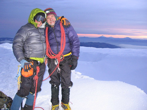
We thanked the mountain for practicing with us, and his lessons, and headed down. The long, long, long, seemingly endless way down. Maybe one of the lessons of Chimborazo was “It never ends. Everything just goes on and on.” On the drive back to Los Banos we stopped in a filthy little restaurant/stand for ‘fritata’. A super yummy side of the road meal, where they hang a whole gutted and skinned pig on a hook, and when you order they cut off some meat and fry it in who knows what, and serve it with hominy (big white corn kernels). Yum. Then to top the trip off, when we got back to Los Banos, we were pleasantly surprised to find out that the town was in the middle of its annual Carnival! Fiesta!
2 comments:
Your journey and the pictures look amazing. Was just checking in to see your progress. I feel like a slug now, my little weekend hikes are a joke in comparison. Thanks, needed the kick in the ass.
Take Care
Jeff
Ahhh... Cotopaxi and Chimborazo, at least have long been in the back of my mind for pedestrian or ski ascents/descents. Congratulations to both of you, Shelly and Rod, on your journey through space, time, and your minds and hearts. I'll check in again later. Buen vaije!
Post a Comment