The high snow mountains of the Cordillera Real are sacred to the Inca and modern campesinos because they control the weather. They bring water/fertility to the high altiplano, but also destruction: hail storms, floods, lightning storms. The mountains themselves are spirits. They can be moody, and need to be pacified with offerings and treated with respect. Of Huayna Potosi, some say matter of factly, “Occasionally the mountain needs to eat someone.”
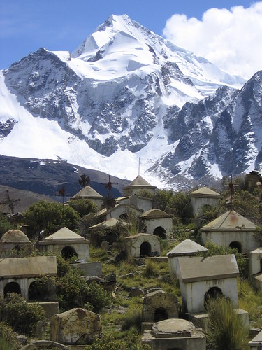
Huayna Potosi (6094 m, 19,974 ft), is probably Bolivia’s most frequently climbed glaciated mountain. Almost every one of the kazillion tour agencies in La Paz offers a ‘guided’ climb of this prominent pyramid shaped peak. The name Huayna Potosi means “young riches”. And they certainly treat tourists as a source of Potosi when it comes to climbing the young one.
We climbed an interesting alternative route, one that no one would be on. The Ruta Francesa climbs to a different peak than the normal route, and is dramatic and steep.
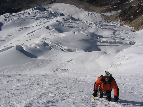 It scales the south east face up to the South summit, the Pico Sur. That face climb was interesting… up to 60 degrees in pitch, and the snow quality just degraded as we got higher. About 400 feet from the top, we changed tactics and started leading pitches with placed protection instead of simul-climbing.
 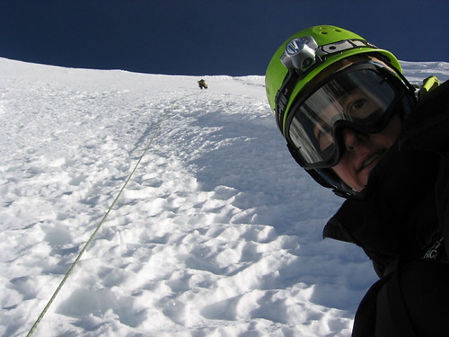 However, when our guide led, he would take off immediately and not place any pro until the anchor… running out ~150 feet of rope in snow conditions where a fall could mean disaster for the whole group. After this we asked to put him on belay at least… hmmmm, interesting!
When we safely made it to the summit, we were surprised to find that the whole summit was a very sharp, knife edge, ridge of snow.
 It dropped even more steeply on the other side, about 150 feet to a nice wide plateau. Straddling the ridge, we set up another anchor and belayed the climb down to the plateau.
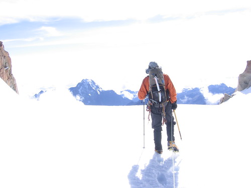
The morning sun was extremely bright and hot for the l o n g walk down (we walked the normal route down).
 When we finally got back to the refuge, and out of the glare, we had a snack and packed up our stuff for the walk back to the taxis. Stepping outside again, we were startled to find that it was all cloudy, and snowing! How does it go from that much sun to snowing in about 45 min!?
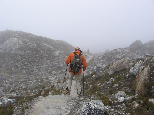
Route description: Follow the marked trail up the rocky south side to the high Refugio. From the Refugio, walk directly onto the glacier and follow the well worn normal route up the ridge. Soon, the normal route crosses over the ridge to climbers right and continues across a broad bowl. Then it turns left over an obvious knoll and onto a wide gently sloping plane with a prominent ridge to the right and the south east face visible directly ahead. When the normal route makes a right turn, over a crevasse, and up the steep slope to gain the ridge on the right, make a left instead and work your way leftward and up through the crevasse field to the base of the south east face. Climb directly up the south east face to the visible peek. Rappel or downclimb the short north west side to a plateau, then move east down to join the normal route for the decent.
A challenging and beautiful climb, on a truly amiable and welcoming mountain.
No comments:
Post a Comment