Chicon: 4/10-12/2007
Because of rainy weather and several staggared illnesses, we have not climbed anthing big yet in Bolivia or Peru. We have done some trecking and a bit of rock climbing, but any aclimization we had from the big peaks in Ecuador is gone (although we have been hanging out at around 12,000 feet for a month and a half). So before we go to climb Ilimani, we are going to climb Chicon (5530 m, 18,143 ft) as a warm up.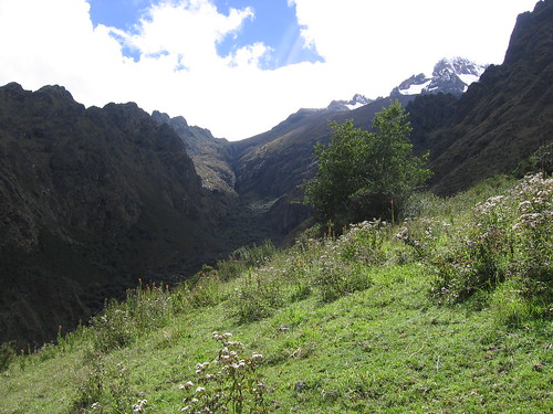 Chicon is a glaciated mountain on the North side of the Sacred Valley of the Incas, outside of Cuzco. This mountain is not often climbed, so we got a local guy, Daniel, to join us and show us the way.
Overall this climb is not technical. The approach however, the climb up the valley, is difficult to find, and a brutal bush-whack.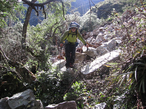 We would not have found it without a local guide. Trudging through the snowy, slippery bunch grasses, avoiding tarantulas on the rocks, and navigating the waterfall covered cliff faces, was tiring and demanding.
 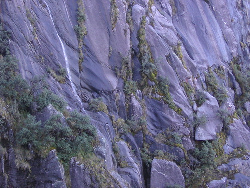 Once above tree-line, the climb was beautiful and relatively simple. A great acclimation trip.
 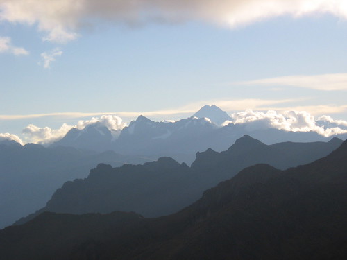 Great views.
Route description:
We get a taxi from Urubamba, up the Chicon valley, to the end of the road. After walking a short way up the valley we scale a narrow ridge on the South side, then traverse and climb steep grasslands to a small col partway up the mountainside. We stop here for some lunch. From here we can see a large talus moraine up along the right side of the cliff-lined valley, leading to a col at the head of the valley. We traverse in the grasslands below the moraine, and head to the col. There are camping spots on the col, but no reliable source of water. We fill up along the way.
From the camp (at about 2:00 am), we continue to head up, staying slightly right, and moving over various morains (2 hrs). When you get to the top of the valley, where there are some creeks from the glaciers, and good views of the glaciers, you see two main peaks. The summit of Chicon is not the prominant peak on the right, it is the one on the left, or in the center of the glaciers... there is a valley with a glacier between the two peaks. Head to the base of the glacier to the left of the Chicon summit. This is a 35 degree, broad rise that becomes less steep, and even wider, above. We head strait up, and then right to cross the glacier field (2.5hr). At the top of the field, move right again to climb up the ridge (the climb may be behind a cornice) to the rocky summit (1 hr).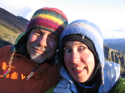
Because of rainy weather and several staggared illnesses, we have not climbed anthing big yet in Bolivia or Peru. We have done some trecking and a bit of rock climbing, but any aclimization we had from the big peaks in Ecuador is gone (although we have been hanging out at around 12,000 feet for a month and a half). So before we go to climb Ilimani, we are going to climb Chicon (5530 m, 18,143 ft) as a warm up.
Chicon is a glaciated mountain on the North side of the Sacred Valley of the Incas, outside of Cuzco. This mountain is not often climbed, so we got a local guy, Daniel, to join us and show us the way.Overall this climb is not technical. The approach however, the climb up the valley, is difficult to find, and a brutal bush-whack.
We would not have found it without a local guide. Trudging through the snowy, slippery bunch grasses, avoiding tarantulas on the rocks, and navigating the waterfall covered cliff faces, was tiring and demanding. Once above tree-line, the climb was beautiful and relatively simple. A great acclimation trip. Great views.Route description:
We get a taxi from Urubamba, up the Chicon valley, to the end of the road. After walking a short way up the valley we scale a narrow ridge on the South side, then traverse and climb steep grasslands to a small col partway up the mountainside. We stop here for some lunch. From here we can see a large talus moraine up along the right side of the cliff-lined valley, leading to a col at the head of the valley. We traverse in the grasslands below the moraine, and head to the col. There are camping spots on the col, but no reliable source of water. We fill up along the way.
From the camp (at about 2:00 am), we continue to head up, staying slightly right, and moving over various morains (2 hrs). When you get to the top of the valley, where there are some creeks from the glaciers, and good views of the glaciers, you see two main peaks. The summit of Chicon is not the prominant peak on the right, it is the one on the left, or in the center of the glaciers... there is a valley with a glacier between the two peaks. Head to the base of the glacier to the left of the Chicon summit. This is a 35 degree, broad rise that becomes less steep, and even wider, above. We head strait up, and then right to cross the glacier field (2.5hr). At the top of the field, move right again to climb up the ridge (the climb may be behind a cornice) to the rocky summit (1 hr).

No comments:
Post a Comment